Mexican Hat to Grand Canyon – North Rim: 220 Miles –Start – stop – start again!
Mexican Hat is just a few miles from Monument Valley, the setting for many cowboy movies of yesteryear. The scenery is reminiscent of the 2007 film “No Country for Old Men”with Tommy Lee Jones and Javier Bardem. And of course, the best time to see the colours of the deep red sandstone monoliths is at dawn. And so, for the second time in a week it was up at 5 and a quick and cool race through the desert to the best viewing vantage point to await the arrival of the rising sun.

Monument valley at dawn

Monument Valley at Dawn
Mandatory photos having been taken, it was back to Mexican Hat for breakfast before leaving once again and stopping briefly in the Monument valley Visitors Centre.

Monument valley from Visitor Centre

Leaving Monument Valley behind in the rear view
Continuing across the flat, hot and dry desert we reached the outskirts of Page in a couple of hours, grateful for a place to quench a growing thirst in this baking heat. This is the home of the Kayenta Indians, the main political body of the Navajo Nation. A few emaciated ponies and scrawny cattle search for scarce blades of dry grass on the desert floor around the poor trailer homes and wooden shacks that now represent the remains of once a large and proud indigenous population. Roadside stands offer handmade arts and crafts to passing tourists, but we saw very few people actualy stopping to buy.
From Page we took a slight detour to the Glen canyon Dam and Lake Powell created by the dam. Constructed between 1956 and 1965 it provides hydroelectricity from the stored power of the Colorado River.

Glen Canyon Dam and Lake Powell
During the construction of the dam and road bridge the disturbed rocks yielded numerous fossils including Pterodactyls, now celebrated in a metal sculpture at the visitors’ centre.

Glen Canyon Bridge with Pterodactyl Sculpture
Returning along the same road towards the Grand Canyon North Rim, the road follows a plateau to the edge, before dropping 3,000 feet into Marble Canyon and a low plateau valley floor through a series of winding curves and straights offering spectacular views…if one could only stop concentrating for a moment on the tortuous road!

Descending into Marble canyon

Marble Canyon from 3000 feet down to the valley floor
As elevation is lost, temperature rises until we reached the low 40’s C (more than 100F). Marble Canyon is a deep, flat desert floor separating the plateau where Page is located from the next plateau which forms the North Rim of the Grand Canyon. The sparse vegetation and lack of water leave the surface essentially bare but for occasional tufts of hardy, yellow grass. At the head of the canyon, and turning the corner is Lee’s Ferry and Navajo Bridge over the deeply incised Colorado River, downstream from Glen Canyon, and then some curious rock formations around the fuel stop and Indian Trading post of Cliff Dwellers.

Perched Rocks from Differential weathering in Marble Canyon

Marble Canyon Cliff Dwellers
Another hour or so of furnace-like heat and we began our ascent into the side canyon leading to the North Rim. With increasing elevation and decreasing temperature, the sweeping bends lead upwards and suddenly the arid, sterile desert changes to tall, dense pine forest offering respite from the searing heat. We arrived at the small tourist centre of Jacob Lake and checked into our rustic cabins.

Cabin at Jacob Lake
With an early start and late afternoon arrival, fatigued from a long, hot, dehydrating day in the desert we showered, washed clothes and congregated for a beer or three on the wooden decks surrounding the cabins and shared the experiences of the day. David, Liz and I resolved to take in the sunset over the North Rim after an early dinner. But having gained an hour through passing through the time zone, and misjudging both the distance from Jacob Lake to North Rim and also the actual sunset timing, it was properly dark before we were even close to a view point, notwithstanding quite rapid progress through the National Park. Noticing deer on both sides of the road in the dusk, we backed off our lively pace and just enjoyed a cool evening ride to the North Rim Lodge and back in what was now, total darkness!
Day 2: Free day to explore at will: Our decision to slow down last night was well made as we discovered this morning that the park is not only the realm of deer. A herd of Bison live very close to the access road through the park, enjoying the high plateau micro-climate providing broad grassy areas between the dense pine forests. It would not have been good to have encountered one of these 500kg beasts at speed in the darkness!

North Rim Bison
The North Rim is much less popular than the very touristic South Rim which I have visited on several occasions. The vastness of the Grand Canyon never ceases to take your breath away as you suddenly peer through the pines and it is there, stretching into the horizon. All depth perception is lost, and although you feel you could almost reach out and touch the interlocking canyons and promontories, the information signs indicate that the opposite flank is some 18 miles away, and the canyon itself is almost 280 miles long and with a depth in places of 1,800 metres (6,000 feet), nearly 2 billion years of geologic history are told in its barren rock walls.
In the early morning, and with a controlled forest fire yielding a constant plume of smoke drifting downwards into the temperature inverted canyon axis, the moody shadows cast by the low angle of the sun give the canyon a sombre majesty. While the view from the South Rim is of bathing the opposite flank, on which we stand, in sunshine all day, the North Rim view is always in shade, muting the deep reds of the thick laminated sandstone layers.

Grand Canyon North Rim View

Grand Canyon North Rim View

Grand Canyon North Rim View
A natural arch of weathered rock reveals glimpses of the Colorado river several thousand feet below.

Colorado River visible through gap in natural arch
Grand Canyon North Rim to Tucson – 473 Miles: Hot or what?
Today is a long riding day from the Grand Canyon, North Rim, to Tucson, Arizona where we will stay for 5 days while the bikes are serviced, in some cases repaired, and new tyres fitted for the next stage of our little adventure.
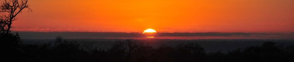
Rising at 5AM to leave at 5:45AM with Peter and Rhonda, I left in the cool (8C), still, darkness of pre-dawn, returning along the same road we used to arrive here two days ago. The early start was not only to get a start on a long riding day, but also to take advantage of the cool temperatures as we expected (and experienced) 42C (low 100’s F)temperatures later in the day. Descending from the plateau that makes up the Grand Canyon North Rim through miles of sometimes steep and winding roads, tree-lined for most of the descent until just as suddenly as we had saw on the way up, the trees disappear and we are once again on the valley floor of Marble Canyon. Even in the pre-dawn, the valley floor was 12C warmer than the high plateau 1000 metres from where we started just 30 minutes earlier. The sun was not yet up, but the hazy half-light began to illuminate the valley sides of Marble Canyon until it peaked out above the eastern flank and bathed the valley in light, and the temperature began to rise rapidly.

Marble Canyon in Early Light

Marble Canyon Early Morning Light
The first 120 miles to the Cameron trading post towards Flagstaff were relatively flat, scrubby grassland and fairly featureless desert. The trading post itself was a surprise as the small door to the building revealed a vast gift shop and substantial dining room in the rear which had an aire of an old casino of bygone grandure, complete with Tiffany style stained glass windows, dark wood frames and furniture and moulded, panelled ceiling. But breakfast was good and being 2 hours into the journey without a morning coffee to jump start the heartbeat, was a welcome break.
Continuing through the non-descript desert landscape we took a single entry/exit on Interstate 17 to enter the Oak Creek Canyon park. Suddenly desert turned to dense forest as we descended from around 7,000 feet to 4,000 feet along a winding road into Oak Creek. As this is a long weekend (Labor day), and this is a popular tourist destination to Sedona, the road became increasingly congested as we reached the main resort area choke point bridge crossing the river. When the trees were cleared from the sides of the road it revealed a steep sandstone flanked canyon. At the end of the canyon is situated the city of Sedona – a clean, popular tourist destination, and today, absolutely heaving with day trippers. After 7,000 miles without a single roundabout, Sedona has more than a dozen, one after the other along a well paved road system. These seem to confuse most drivers as no-one apparently knows the priority system, so near misses were frequent as we navigated out of the base of the canyon and back into another 100 miles of featureless desert.
The road started to rise again across a ridge, and again the landscape changed as we approached the Roosevelt reservoir and dam. Organ pipe cactus started to appear, and in a few miles were abundant on each side of the road as we crossed the desert floor towards Tucson, with the foothills of the Santa Catalina mountains. The temperatures were now into the low 40’s C, traffic was light along the country roads which we took to avoid the interstate highway. Approaching Tucson in the late afternoon the sun sank slowly until reaching the outer fringes of this expansive, mostly single storey city. When the last rays slipped beneath the horizon, just as the sun had suddenly appeared this morning, it was gone and the ominous dark clouds and lightning streaks across the sky to the south enveloped us in darkness. We arrived in the Sheraton at 7:00PM after more than 13 hours of hot, dusty riding with just 3 breaks. Cool beer greeted us in the foyer of the hotel as the new riders who are joining us in Tucson for the next leg of the journey south had anticipated our dehydrated arrival!
Cheers!

- Organ Pipe cactus – Tucson
We have 4 days in Tucson to undertake a number of activities. Priorities first…the bikes need servicing and tyre changes. We are us8ing hybrid road tyres until we reach Santiago, Chile as we do not expect to have to negotiate serious off road conditions until then. The regular 6,000 mile service has already been exceeded by more than 1,200 miles. Some running repairs are needed for some bikes that have had minor scrapes and tumbles on the way, as well as some more serious mechanical breakdowns. next item…mexican Insurance which can only be taken out locally….then buy pesos for entry into Mexico, and some single dollar bills for minor tips and such.
But today was a totally free day having picked up the bike, purring nicely again, and with temperatures in the low 40’sC (106F) it was a day for air-conditioned activity. We chose to visit the Pima Air and Space Museum which is adjacent to the Davis-Monthan air Force base. Apart from an excellemnt museum of old aircraft, there is also what is known as the “boneyard”. Seemingly the very low humidity (less than 5%) and hard pan rock surface of this part of the US is ideal for storage of old aeroplanes…and there are 4,500 of them here. Almost all (99%) arrive here under their own power, landing on the base, and are then either mothballed for fuiture use (about 20%) or simply parked in rows until someone somewhere needs some spare parts. Since many US aircraft have been sold to many other countries, and are still in use, this is a valuable source of replacement equipment. Engines, body parts, electronics, etc etc. We took a 1.5 hour, expertly narrated bus tour of the facility, starting with “Celebrity Row” in which examples of the most famour aircraft are displayed. After arrival, the aircraft are sealed against the elements with a coating of black and then white latex. All fluids are drained and then the aircraft are towed to a resting place. Lines upon lines of famous types….Tomcats, A-10 Tank Busters (“Warthog”),B52’s, C130’s, ex-presidential ‘planes, helicopters, trainers, attack aircraft, tankjers, cargo, etc. are present. Later we took a tour of the various hangars with pristine examples of the SR-71 “Blackbird”, Flying Fortress, Liberator, Mustang etc. all very impressive.

SR71 "Blackbird"

Lines of mothballed Boeing 707 Tanker aircraft

Lines of mothballed fighters wrapped in latex

B-377 "Super Guppy"
There are also many examples of quite exotic aircraft such as the Super Guppy (above) used by NASA to transport parts of the space shuttle, and the Sky Crane helicopter (below) used as a heavy lift aircraft

The Sky Crane
Perhaps the most rewarding part of the visit was to the 390th Memorial Museum commemorating the exploits of the B17’s Flying Fortress during the WWII era. Sitting in front of a pristine B17, an elderly gentleman, in his mid 80’s, recounted the stories of bombing runs over Germany during 1943-45 when he piloted 28 missions at the age of only 21.

B17 Pilot recounting stories of 28 missions
Tonight, early to bed as we are up at 4:30 to leave by 6 for Mexico and a whole new chapter in the adventure. If I am quiet for a few days, it will be because we have no internet or network coverage….
