Ecuador – What a delight…and an adventure

Ecuador Border to Quito: 170 Miles:  A race across the
equator against time!

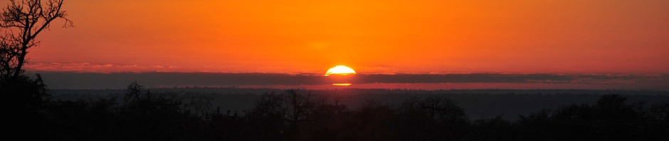
The sun had shone during the long wait at the border crossing, but now the clouds were gathering as we set off.  An early wrong turn delayed us by 30 minutes and with only 3.5 hours of daylight left and 150 still miles to go, it was going to be a challenge to make Quito by sunset, especially as we are passing the Equator as we go and of course need to document that in the appropriate photographic manner.

The road started to rise up again, and the mist turned to rain drops.  Stopping to put on the waterproofs, in another 200 yards the heavens opened up and gave us a proper soaking for the next 5 miles or so.  We heard later that the next group to escape the border process were caught in not just torrential rain, but a heavy hail storm leaving inches of ice on the road and causing a landslide which had to be skirted with a long detour before continuing.

The long wait in the border, lack of time to stop for lunch and increased concentration levels for the rain meant I was starting to feel weary.  We stopped for a coke and an ice cream to build up sugar levels and sharpen the wits even though we were short of time.  Mission accomplished we set off with new vigour and on excellent road surface began to make up time.  I should mention here that the roads in Ecuador are really quite superb so far.
My first surprise in Ecuador is the temperature.  Having lived and worked close to the equator in both South America and Africa, I am accustomed to hot, steamy, humid jungle type climate.  But the fact that we are entering Ecuador through the Andes from 6,000 to more than 9,000 feet ab0ve sea level means that the scenery is more likely to have snow-capped peaks than tropical vegetation.  I should have done more homework clearly!  All of my winter clothes are neatly packed in my top case at the back of the bike, but my jacket is accessible, so on it goes and stays on for the next few days!  My other immediate impression was the landscape usage.  I was impressed in Guatemala by the family sized, well-tended subsistence crop fields, and here again Ecuador I see the same thing which indicates hard working people and family traditions of tending crops and taking responsibility for their own support.

Ecuadorian scene - mountains with farming plots

The stop at the Equator is of course obligatory, notwithstanding the time pressure.  One would think that this significant milestone on the Pan American Highway would be a well signposted tourist trap with many opportunities to relieve passing tourists of their vacation money.  But although we had our GPS satellite Navigation set for 00 degrees, 00 minutes and 00 seconds, we had a hard time actually locating the monument. Some 10 minutes of double backs and circles around the ramshackle buildings and we stumbled across a gap in a fence, just wide enough for a bike to force its way through, and captured the photo we wanted.

One wheel north...and one wheel south of the equator

It was now after 5 PM and with still around 50 miles to go we set out for Quito.  The road rises on the outskirts of town and as traffic builds up the entry into town in the dark is not exactly desirable.  The route notes only give an approximate geographic location and in a city of 1.4 million people this could have given us a problem. We stopped for fuel on the approach road, and by chance the support vehicle came by and gave us a chance to follow him to the hotel, Café Cultura, in the northern sector of town.  All in all a long day, and quite tiring, but my first impressions of the country, city of Quito and the people we have encountered have been positive.

Quito – Day off:  Basilica, Cathedral, Cable Car and Theatre….a full day

Quito is a modern, bustling, enjoyable city….but watch out for pickpockets.  Fuel is subsidized at $1.50 – $2.00 a US gallon depending on octane rating, so taxi rides are very inexpensive.  A typical 20 minute ride is no more than $2.  Having consulted the tourist guides, the popular places to visit are the Basilica and Cathedral; as well as the other old colonial style buildings, palaces and official buildings in the old historic centre which is not only well preserved and maintained, but also easily accessible.  On Sundays, it is even blocked off for pedestrians and cyclists.

On the night of arrival we went to a buzzing square just a short 5 block walk from the hotel with restaurants, bars, dancing, etc etc and crowds of people of all ages.  Food was good and the prices very reasonable.  On subsequent evenings we chose a slightly quieter place for dinner and found an excellent Italian restaurant called Cinquecento (“500”).   Our tourist day was well spent.  A short taxi ride to the historic district firstly took us to the basilica.  I was with Monica, my riding companion, and another couple, Alan and Margaret.  We of course wanted to climb the 374 steps to the top of the bell tower, but on the way up we were a little disappointed to find a lot of graffiti on the staircases, bell tower and intermediate levels.  The basilica itself is a neo-gothic structure, started in 1892 and completed (if it can be called complete even now) in 1992.  While the original Gothic cathedrals have stone mason crafted blocks, this one has concrete, and is not quite authentic.

Quito Basilica

Quito Basilica Aisle


Quito Basilica Window

Notwithstanding, the views from the tower over the city are impressive.  The European concept of Health and Safety does not apply as the stairwells to gain access to the towers are exposed, steep and with poor hand rails.  Not for people with vertigo!

Basilica Tower Staircase

Bell Tower

Next on the agenda was Plaza Grande surrounded by the Presidential Palace on one side, the Municipal Palace on another, the Cathedral on the third and I cannot recall what else on the fourth!

Quito Old Town

Quito Old Town


Quito Old Town

A brief lunch in a local restaurant prior to discovering the Cathedral
was followed by a brief drama.  A common trick played by pickpockets is to spray some foam or other liquid on the backs of tourists and while they are distracted, snatch the purse, camera, phone etc.  As we were walking to the cathedral, with the ladies, Monica and Margaret in front, I saw a young man with a mustard bottle in his hand (presumably stolen from a restaurant), spray a line of mustard all over the back of Margaret.  I grabbed his shoulder and in his surprise at being apprehended wriggled and ran away.  As he was probably carrying a knife to slice through the shoulder strap of the purse, his escape was probably the best outcome.

But we did not let it spoil our afternoon.  The entry to the cathedral was via the museum, on a side street.  With only $1.50 entry fee and a free tour guide (I translated for the group), our expectations were not exactly high.  We were surprised.  The tour guide was excellent and very knowledgeable, and the tour lasted probably 2 hours.  She earned a substantial tip!!

Quito Cathedral

Cathedral Altar

Santa Ana Chapel

Our next adventure after walking around the downtown area was to catch a taxi to the cable car to mount Pichincha.  At 4,100 metres(around 13,000 feet) it towers more than 1200 metres above the city.
The cable car was put in several years ago, along with a significant tourist infrastructure.  Sadly the tourists just never showed up in the volumes expected and much of the infrastructure is now in disuse.  The view of the city on the way up and back down is impressive as the city extends for miles in the valley.  But at just over half way up the
cable car ride, the clouds obscured everything and at the top the visibility was around 50 metres….and the temperature no more than 8C!  Brrrr…….

Quito view from cable Car

The final stop for the day was the National Theatre to see the Beijing Opera company peform a very Chinese classical opera….a lot of screeching and scraping instruments, but a good evening of culture anyway.

National Sucre Theatre

Quito to Quito: 200 Miles………a little adventure!!!

Today was supposed to be a longish day from Quito to Baños de Cuenca.  With an early start we had hoped to not only explore the old colonial town of Cuenca, but also partake of the thermal springs of Baños.  But, the best laid plans of mice and men…and all that or as the Spanish say “el hombre propone pero Dios dispone” or on other words things just did not turn out the way we expected.  The plan was to leave by 6:30 and avoid much of the traffic exiting Quito.  Setting off as three bikes, Allan and Margaret, Monica and myself, we headed south along the Pan American.  Between traffic and fuel stops we separated, and feeling quite pleased with progress, Monica and I arrived in the town of Ambato at around 100 miles, by just after 10 AM.  The roads were good and the traffic manageable.  We stopped for a brief drink break just outside of town, but then a wrong turn on the by-pass and we were entering into the town outskirts.  I was following, Monica leading.  Her GPS started to act strangely so I took the lead.  Having lost sight of her in my rear view mirror I turned back to find her somewhat concerned that she had lost her document wallet with passport, licence, credit cards and cash…  seemingly she had taken it off from around her neck at the drinks stop to put on an extra layer against the cold and left it on the back of the bike….it had now fallen off somewhere, but as I had only taken over the lead in the past mile or so, it had to be in the vicinity.  We searched up and down the road to no avail so contacting the group leader we set about filing a police report for lost documents.

Flagging down a passing police car we followed them to a police station and found that the process involved a lawyer to write the report, the police to accept the report and the ministry of the interior to stamp and authorize the report before it was considered ready…and of course each office was in a totally separate part of town!  But speaking Spanish has its advantages, and as a Castilian Spanish speaker it seems to get attention.  So with the “Denuncia” in hand, stamped, signed and authorized, we headed back to Quito to try to obtain replacement documents.  Of course in the meantime phone calls to banks and credit card agencies to cancel the cards and emails to pass on requests to Monica’s spouse to take care of arranging new ones.

We arrived back in Quito just in time to miss the US Embassy by 5 minutes.  But armed with requisite paperwork the following morning at 06:45 we arrived at the embassy at 7 and as an American Citizen she was given priority treatment.  In 2 hours she had a new passport, albeit with only 6 pages for entry/exit stamps. Easy part over..now to Ecuadorian government office to get an immigration stamp…. Again with copies of old and new passports, the stamp was duly placed in new passport within an hour.
Next American Express Office to try to arrange a new AmEx card, cash facility and ensure cancellation of old card had taken place.  An hour or so later, mission accomplished and card could be issued in Santiago, or Cuzco, or somewhere else and cash facility set up too.  Final task was the replacement of the temporary import document for the motorcycle with the Customs agency. According to the paperwork which we received at the frontier, and of which I still had my copy, if one loses the document you have only to show up at the local customs office and they can print you a new one from the computer system.  Sounds simple….but after visiting 3 customs offices and receiving multiple blank stares when we showed them my documents and the apparently simple process we were beginning to be concerned.  We had also wasted more than an hour waiting on various people to come back from lunch only to find they could not help us.  Eventually we
found someone who could help..or at least find help.  He was in charge of the “Frontier Security Office” which was next to the “Frontier First Line Office”.  He walked around the various office for us and found someone who was responsible for duplicate documents…..but he required a physical inspection of the bike again.
So a taxi ride back and then on the bikes to the airport offices of the customs agency…..and of course there was also the question of a type written official looking, letter to explain why the other document had been lost.  With my best Spanish and pleading look we asked our new found friend in the Security office if we could borrow his secretary to write the letter for us.  To our surprise the officer himself took it upon himself to personally write the letter and walk us through the process.
Letter submitted we waited for the final copy of the documentation to be printed…..and waited…and waited…the officer was in a meeting….the office closes at 5PM…..still in a meeting…….4:59PM..officer shows up and signs the letter.  All in all not a bad day…passport, immigration stamp, AmEx and Customs all accomplished.  Exhausted but happy, it was another Italian meal!

Quito to Loja: 420 Miles – Catch up part 1

The rest of the group had already left two days before, as we did, but returned to Quito.  We now had to catch up which meant riding a day-and-a-half distance for two days.  And a border crossing all without support.  I forget to mention that one of our other riders was also delayed in Quito with some mechanical problems, so there were three of us.

We set off early, but the requirement to drop additional papers in the US Embassy delayed our departure from Quito until 8:30.  With the US Embassy on the North side of town, and us heading South. We had to cross the entire city in the morning rush hour which took more than an hour to accomplish, notwithstanding some “assertive” driving.  But once on the excellent roads outside of the city we picked up a good pace. With long stretches of 4 lane highway, and good 2 lane in between, and with only moderate traffic we made good progress.  But there was no time to stop for photos.  I did grab a couple simply because Cotopaxi volcano was too good to miss and the mountain scenery we passed through was indeed breathtaking.

Volcano Cotopaxi - snow covered summit

Road to Loja

Road to Loja


We spent the day between 7,000 and 11,500 feet in the Andes and arrived on the outskirts of Loja as it got dark.  Some roadworks sent us onto deep mud and gravel, impossible to “read” with just headlights, but we made our way through.  Stopping for fuel on the edge of town we found some police motorcycle riders who came over to chat and ask what we were doing.  I asked if they would like to provide an escort to our hotel, so with blue lights flashing and a 4 bike convoy we were whisked through the evening traffic to our hotel in style.  We invited them to join us for a drink….a soft drink, of course!

Juan and Roberto - Our friendly police escort!

The hotel was good, but with breakfast only being served from 7 Am, and with 120 miles to the border and 230 miles the other side, we left as early as we could.  The road to Loja was excellent as have been nearly all the roads in Ecuador. But the road to the frontier was the worst we have encountered so far.  No significant potholes or landslides, but constant patches of tarmac over older patches, and impossible to gain any real speed as we dropped through innumerable bends and switchbacks from 8,000 feet to almost sea level at the border over 120 miles.

Loja top the Peru border

Arriving at the border after midday we first of all exited ourselves from immigration, and then our bikes which as usual involved an inspection and documentation verification to make sure it was the same bike we came in with.  As Monica’s documentation was all replacements for the originals there was the possibility of problems, but all went well.  Now drive across the bridge to the Peru office. Again personal passport entry followed by entry of the bikes through customs.  Again no problems, but when we started the customs process the officer asked me to sit with him at the desk to walk through all the computer entries and paperwork. I did mine first to learn the process, followed by the other two.  Of course with a Brit, American and Australian registered bikes, there were three different processes!! We were on our way, with 230 miles to go, by around 3 PM…welcome to Peru!

Posted in Uncategorized | Leave a comment

Colombia – Heading south on the Pan American

Medellin to Alcala – 195 Miles: A day of two parts with an exciting end

We are now heading south again having approached the southern limit of the Darien Gap. We left early, Monika and I, to avoid the traffic.  Not early enough as it turned out as the morning rush hour was in full swing and to gain access to the main road skirting the west side of the city we had to cross town.  Fortunately the SatNav I bought in Panama was working well, as the route notes were less than helpful in the many changes of roads to leave town.  In all fairness, the only time that Colombia has been on the itinerary was in 2009, and at that time they had escorts and local knowledge with them as it was the security scouting trip, so the route notes are not necessarily as accurate as they might otherwise be.

It was raining – not hard, but enough to mix with the thin film of diesel on the road surface and keep speed down and concentration up.  Remember that yesterday we had new tyres fitted, and until they are “scuffed in” for 60 miles or so, the moulding process leaves a rather slippery surface in the wet.
Heading south on route 25, the Pan American Highway through Colombia, we first encountered a mountain section, twisting and turning through narrow 2 lane roads, the barrios of the Medellin outskirts on each side, and landslides and road works contributing to the slippery mud, exacerbated by hundreds of heavy trucks slowly plying their way up or down hill, belching black smoke from their tail pipes.  And so it went on for perhaps 80 miles.  At times as we rose into the cloud forest, the visibility was reduced to just a few metres and speed reduced accordingly.  The route notes suggested taking a loop across some scenic mountains to the west, but as the visibility was so poor due to low cloud, we opted for the direct route down the Pan American.

Cloudy ride to Alcala

Cloudy Ride to Alcala

Arriving at the town of La Pintada, we stopped for fuel and a very good cup of coffee with pastries.  During the break the clouds dissipated and the sun shone, raising the temperature and the spirits for the next leg of the journey.

In sunshine, dry roads and with tyres now scuffed in, we picked up the pace and for the next 60 miles or so through continued mountain roads the ride was one of the most enjoyable we have done so far.  Spectacular scenery of cloud forest covered mountains, fast flowing rivers and local plantations of bananas, plantains, sugar cane etc.

Fast flowing, muddy rivers through cloud forest valleys

But then the heavens opened up and after stopping to put on the waterproofs, it was again a slow pace through the bends until once again the sun came out and the roads dried up.  The scenery changed with the clouds lifting.  We came across a cemetary on the side of the road in the middle of nowhere.

Cemetary on Pan American in remote village

We encountered several police and army road blocks, some with radar guns, and although at times we were moving a little “briskly”, they seemed to have no interest in us, and we just waved to them as we drove past.  A second stop at around 160 miles for a light lunch before turning off the Pan American to head for the hotel for the night.

Hotel Bosque de Saman is a working coffee plantation of 250 hectares, I am told.  Rising up the hillside to around 5,000 feet it occupies a prominent position with spectacular views…when the clouds aren’t obscuring them!

View from tyhe Coffee Plantation

View from Coffee Plantation

In order to diversify from coffee when the price dropped a few years ago, the plantation has an eco-tourism theme as well as an “adventure” feel with zip lines and cable bridges across the fields of coffee bushes and bananas.  The 7 interconnecting zip lines are from 150 to 450 metres in length, from 35 to 80 metres above the plantation below, and can reach speeds from 35 to 80 km/hr.  Having done zip lining before, I was one of the first in line to do it again.

Flying the Zip line

A group meal followed with all food produced by the property, including all fruit, vegetables and fish from their 3 lakes.

Alcala – Popayan: 210 Miles: The Pan American at its best

The plan was to leave early…at 7:45 as breakfast was to be served at 7.  But I assume that 7 AM just means sometime before 8, so at 7:40, we sat down to breakfast.  It was raining lightly, though more a fine mist than actual rain.  The kind of weather that leaves you frustrated about wearing waterproofs or not.  From Alcala to get back to the PanAmerican was about 20 miles of initially farm track, then urban cobbles and concrete, then asphalt.  Once on Ruta 25, the Pan
American again, the road turned into a well paved, 4 lane highway, the like of which we had not seen for a considerable time. With partly cloudy skies, the promise of sunshine, dry road surface and temperatures in the mid 20’sC, biking does not get much better than this.  From the 5,000 feet elevation of the coffee plantation we were now in 3,000 feet elevation flattish plain, and coffee had given way to sugar cane…but on industrial scale, from one green mountain horizon to the other.  The cane is cut and transported by road “trains” comprising a heavy truck unit pulling up to 5 trailers, which emerge from the sugar cane fields and snake along the highway to the processing plant.  To pass one of these slow moving vehicles takes about a hundred metres as each trailer is at least 20 metres in length….not easy in heavy oncoming traffic.

The sugar cane road train

The Ruta 25 then takes a turn back into the mountains on the other side of the valley, rising again from 3,000 feet to over 6,000 feet with the 4 lane now giving way to 2 lanes again and the straight roads giving way to twists and turns once more.  On this section we encountered a major street procession blocking a mile or more of the
main highway and causing a queue of trucks several miles long.  The demonstration was to protest against a new law (“Law 30”) which will introduce private capital into the schooling system to keep schooling free while maintaining or improving standards.   The school teachers, who are quite well paid, have stirred up public emotions and the graffiti on the city walls expresses the level of emotion.


Protest slogans on every wall against "Ley 30"

The other thing which really struck me today was the temperature and the humidity…or lack of them. As we arrived in the old colonial city of Popayan, at only 2 degrees north of the equator, the temperature is a very bearable 20C, and the humidity equally pleasant, owing to the elevation.  Our hotel for tonight is the Dann Monasterio, which as the name suggests, is an old monastery, now a 5 star hotel……tough break!

Dann Monastery - now a hotel

Dan Monastery - Central patio at night

Popayan is a modest size town of 2 storey, colonial style buildings, and a thriving, vibrant environment with crowds of people in the streets and the main square at 4 o’clock on a Wednesday afternoon.  Care has been taken to preserve and enhance the old style and roughly cobbled streets. Having suffered major earthquakes, and been essentially rebuilt every hundred years or so, it also boasts many fine churches on account of it having sided with the Spanish in the Bolivarian fight for independence.    The last major earthquake was in 1983.

Church adjacent to Monastery

Popayan Square

Some new buildings are designed sympathetically to the original buildings, keeping to 2 levels and with architecture to match.

Popayan to Pasto – 160 Miles:  A mixture of everything

The monastery was excellent in service, room comfort and location.  Popayan was an enjoyable stopover, and the downtown area enjoyable top walk around.  But we had to leave as we are making the border crossing tomorrow.  We were ready to leave, Peter, Rhonda, Monica and I at 8:30, but until the guard on the car park was sure that we had all paid our bills, he would not open the gate to let us out!  I guess they must have had some runners in the past.  So at nearly 9 AM we set off, and quickly discovered as we exited through the other side of town that it was much bigger than we had initially thought from our wanderings last night.  Heading south all day on Ruta 25, The Pan American, the road was very mixed.
The first 50 miles was through winding mountain roads, gradually dropping from around 6,000 feet elevation to 2,000 along a ridge and in line with the axis of the adjacent valley. Heavy traffic in both directions, long convoys of trucks and busses belching diesel fumes and blind corners made for very slow progress and it took 2 hours to do 50 miles.  The road was also not that great, with deep and numerous potholes which at times required a slalom approach to riding.  At one stage we came across a long line of trucks, not moving.  Making our way slowly towards the front of the line we found that the reason why was that the road had collapsed down the hillside and a crew were excavating into the hillside to create new road.  With alternate traffic allowed through in each direction and an hour or so in between to allow the road crew to do their work, it was going to be a long wait. But to our surprise we were waved through immediately to wind our way through the machinery and also the deep, churned up mud.  Somewhat reticent, I edged forward slowly, feet down, skirting around the bucket of the excavator, about 2 feet from the edge and a steep drop.  Thankful for a quick and safe exit, I then headed off, but this time with no traffic in front, or behind as it was all stopped at the landslide.

The next section through the valley floor was hot, dry and again with fairly poor roads we found several sections of collapsed road, one involving a drop of about a foot which I did not notice till it was almost too late.  Standing up quickly to put weight on the front wheel I jumped into the hole, grounded front and rear suspension and both foot pegs, but the bike just soaked it up and carried on like nothing had happened.  These really are amazingly strong machines.

With 45 miles to go, the road started heading upwards and we gained over 7,000 feet in a matter of 15 miles or so.  The road was a mixture of good asphalt, broken surface and gravel, and deep potholes…..all within a few hundred metres… ..and repeat.  But the scenery was spectacular with deep, green, ravines with a river running at the base.  It began to cool down too.  At the base we had a temperature of more than 33C, but in the upper elevation it had dropped to below 20.  Rising through the sides of the ridges, with interlocking spurs of green ravines in both directions, and not another soul in sight for some time, we suddenly levelled out into a high plateau pastureland, 5 fuel service stations one after the other, a village and large truck park…all at around 8,000 feet overlooking an unbroken horizon of mountains and valleys….really quite bizarre, almost surreal.

Popayan to Pasto

Popayan to Pasto

The last 20 miles was great asphalt, slowly dropping into the city of Pasto.  Another bustling metropolis, Pasto is a mixture of old and new superimposed on a grid-iron pattern of streets.  The adjacent mixture of old and new buildings just does not seem to know what it wants to be.  Ancient churches with modern offices attached, old passages with Moorish architecture next to concrete buildings.  But the purpose of staying here is that we are close to the border with Ecuador at Ipiales tomorrow.

Popayan to Pasto

Having walked around Pasto for more than an hour looking for somewhere for lunch, and finding only fast food establishments, we headed back to the hotel for lunch and called it a day for sightseeing!

Pasto Square

Church in Pasto

Pasto – Ecuador Border – 50 Miles:  Hot and Cold?

As today is a border crossing we left as a group to ride to the border with Ecuador: About 50 miles. Even though we are within a degree of the equator, the temperature continues to be very cool as a consequence of being at 8,000 feet above sea level.  The ride was in some ways a repeat of yesterday with deep ravines draped in a green velvet coating of cloud forest.  Initially dropping to 6,000 feet before rising to a ridge at 10,500 feet, the mist returned as we rose into the clouds covering the mounta8in peaks.  The temperature dropped to 10C and I was pleased to have opted for my jacket this morning. Again dropping to around 8,000 feet elevation we arrived at the Colombian – Ecuadorian border.

The well-trodden path of border crossings repeated as we exited ourselves, then the bikes:  a fairly swift process of no more than an hour and a half.  But the process of temporary import of a vehicle is always the longest.    It is not that each vehicle takes so long, but the cumulative impact of 20 bikes and support van took nearly 4 hours to complete, and as I was closer to the back than the front of the line, it meant that the remaining 170 miles or so to get to our destination of Quito was not started till after 2 PM, having arrived at the border before 10 AM.

Colombia Ecuador Border.....another 4 hour process

Colombia Ecuador Border - Keeping the spirits up while waiting: Drew and Monica


Posted in Uncategorized | Leave a comment

Colombia – Anyone for Coffee?

Panama to Colombia– By ‘plane

After all the border crossings in Central America the exit via the airport was a breath of fresh air. Although we had to get up at 3:30 to load the luggage on the vans, and then depart at 5AM, it was not a hard day.  But of course, this would not be an adventure if we did not have some unexpected activities…..the first was that the 32 kg checked luggage limit plus 10 kg hand luggage that we were told by the travel agent, and actually had on our ticket, was in fact incorrect, and the 32 kg included the hand luggage.  As we had to take everything out of the bikes for shipping, including all the tools, air compressor, locks, covers etc, meeting the 32 kg limit was a challenge…..the alternative being $50 excess baggage which several people had to pay.

The passport control and departure procedure was like any modern, efficient airport…so why could it not be like this in the land frontiers?  The flight to Bogota was quick – just over an hour, but the cloud cover prevented us from seeing the Darien Gap landscape, and appreciate exactly why we could not get through.  I read a book once about a Range Rover expedition through the Darien Gap.  It took about 5 months to cover the 150 miles or so.  Since we don’t have 5 extra months to spare, airfreight seemed like the logical choice. Although, I think sea freight and a short voyage to Cartagena in Colombia might also have been a pleasant alternative.

The arrival in Colombia was equally efficient.  Less than 5 minutes and we had our passports stamped and after picking up the luggage in a modern and efficient baggage handling hall we were standing waiting for the van to pick us up and take us to collect the bikes, which had also flown over at the same time as us and were in the process of being unloaded from the cargo aircraft. While waiting we had a good chat with local police.

Chatting with police at the airport

The Colombian temporary import process was fairly straightforward, but with 20 bikes, still took about 5 hours to complete the formalities for us all.  I was in the first group and, having received my paperwork, was off to collect the bike from the bonded warehouse.  The exit from the loading dock was fun…. They hooked up a wooden ramp against the dock, with a 6 inch height gap just after the point of no return, so with a flick of the throttle, it was airborne and touchdown on the ramp.

Down the ramp from the loading dock in bonded warehouse

Unfortunately it was raining, quite heavily, and so my first experience of Bogota was in heavy traffic which knew where it was going, and me not familiar at all with the roads or accustomed to Colombia driving practices, which turned out to be quite aggressive.

Bogota – 2 Rest Days – A surprise and a disappointment

It has only been 4,500 miles since the last service and tyre change, but as it will be another 6,500 miles till we find another full service BMW motorcycle dealer, we are undertaking a service here.  So with bikes delivered to  “Autogermana” and copious cups of good BMW Colombian coffee while we waited to book the bikes in, we enjoyed a little Colombian hospitality.

We stayed at the Dann Carlton Hotel…..along with the Colombian National football team, so security was a little tight.  But we did get to see them all at breakfast the following day.

Police Security at Bogota hotel

I was quite surprised at Bogota.  With 7 million inhabitants it is a vast, sprawling city covering a large plain between mountains. Although there is an area with skyscrapers which I assume to be the Central Business District, there appears to be no specific “heart” to the city.  The city extends for miles in all directions. The roads are wide, with ring roads, flyovers, underpasses etc,  but very confusing, not only for visitors like ourselves but also for taxi drivers who don’t seem to know the city very well.  Giving them a major landmark to focus on seemed to be the best process.

Bogota skyline against mountains

The old town is called the Candelaria, where the main Bolivar Square is surrounded by impressive buildings. But unlike the old colonial style cities of Mexico and Guatemala for example, here the old buildings are crumbling and not maintained.  As one falls down it is replaced by a modern concrete and glass building quite out of sympathy with the surroundings.

Oldest church in Bogota - 1540's

Santa Fe Church - Bolivar Square

Candelaria historic district - old and new

Candelaria historic district scene

But a trip to the Candelaria is mandatory as there were two highlights:  The Gold Museum with 33,000 gold artefacts from pre-conquest Colombia dating from as far back as 2,000BC.  It was curious to see metal working so long ago when the Mayan Classical Period of 400-900 AD had not developed metal working at all. The other highlight is the Botero museum.  Although I was not familiar with the name, the artist’s work is something that one has seen before..I just did not know who the artist was.  His penchant for
super-sized characters, especially in everyday situations and female nudes shows through in all his works.  Fernando Botero was born in Medellin in 1923.

Botero painting

Mona Lisa - Botero style

The museum itself is a jewel in the heart of the Candelaria and very well preserved.  Apart from the large number of Botero paintings and sculptures, there were also works by Picasso, Degas, Dali, Lucien Freud, Henry Moore and a myriad of other famous artists.

Botero Museum

Botero Museum

Another area that one has to visit is the Zona Rosa (“Pink” zone). This is a large commercial centre, shops, restaurants, bars etc…but once again, all modern and very little “character”.  Later we collected our
bikes from the dealer, all clean and shiny again after a comprehensive valet service….and you can guess the bill showed it too…. The acronym BMW means “Bring My Wallet” !

In summary, although the capital city throbs with the beat of a large metropolitan area, it lacks any special character from my brief exposure.  The traffic is horrendous, and taxi drivers went to the Schumacher school of driving it seems as most corners were executed on two wheels and a door handle. I was disappointed that the old historic district was so run down and no attempt appears to have been made to preserve the character.  The gold museum and art gallery were exceptional.

Bogota to Medellin – 310 Miles:  Sunday is washing day

We left Bogota at 8AM on a Sunday morning, hoping for an easy exit. The traffic was already starting to build, and as we customarily leave as a group at the start of a leg of the trip, trying to stay together was a real challenge.  Driving for nearly 20 miles through the city and suburbs, we eventually arrived at some open country and the group split up for the rest of the ride.  Once again I was underwhelmed with the architecture we encountered…it was just mile after mile of fairly non-descript buildings and roads.

Talking of roads, outside of the city, most of the roads seem to be toll roads.  Given the bad state of repair of many that we encountered, I don’t know where the toll money is going, although signs indicate that there is free recovery service for breakdowns and also free ambulance service, so perhaps that is the intended purpose of tolls.  But motorcycles are free, and there is a gutter type arrangement on the side of the toll booths where motorcycles can pass through……of course they are made for much smaller bikes and so a fully laden touring bike has about 2 inches of clearance on each side!  In some places the franchisee of hte toll booth has built up a wall with flower planters to beautify the bike lane, leaving even less space for us to pass through.

We started to climb the mountains along twisting, winding roads, one lane in each direction and with heavy traffic.  Most of the vehicles today were heavy goods or tanker trucks, belching diesel smoke and very slow.  With winding roads and very slow progress, a column of 10 or more trucks was a major obstacle to pass, requiring some “assertive” actions.  Thankfully the bikes are very quick to pick up speed and fully up to the task when passing opportunities present themselves.  It was never wet, but never really dry either, and as we gained height through the cloud forest in this part of the Andes the visibility was reduced in places to just a few yards.  When it did clear, the scenery was of a series of mountain ridges and valleys covered in trees.  There were also frequent road works where the hillsides had collapsed, either causing landslides or subsidence.  The first 100 miles took more than 4 hours, and with 300 miles to complete today, we had to pick up the pace.

The first 100 miles Bogota to Medellin - typical scene

I think the above photo pretty much summarises the first 100 miles…collapsed roads, mist, heavy traffic, belching diesel fumes.

The next section of about 80 miles was across a wide plain between rounded, tree clad mountains. The road improved and the truck traffic declined.  There was still a reasonable amount of traffic, but with straighter roads and good visibility we picked up speed and time.  The main feature here was the Magdelena River, which draining the surrounding mountains, was broad and turbulent, flowing under the metal bridges in a boiling maelstrom.
As we passed through the towns and villages along the way we noticed that Sunday must be washing day.  We saw this in Panama last Sunday where every washing line of every house was full.

The last 80 miles or so into Medellin was somewhat similar to the exit from Bogota:  A series of mountain ridges and valleys, twisting and turning but this time with less truck traffic.  Arriving in Medellin at nearly 6 PM and in darkness, we descended into the city along a steep and sinuous 4 lane divided highway for what seemed like 20 miles or more.  The city occupies a broad plain between mountains rather like Bogota, but also creeps up the mountain sides, illuminated like a star studded sky against the dark background.

All the way along the road today we encountered police and army road blocks.  Being Sunday, the army was represented by young men who looked too young to shave.  What they might do if they had to use the heavy weapons they were brandishing, I don’t know.  As always, I waved at each check point as I approached and bade them good morning/ afternoon as I passed through.  This was almost invariably greeted with a friendly wave back and an awestruck gaze at the bikes.

Medellin – Rest Day: and a walk on the wild side

Tyred again. It has been less than 5,000 miles since our last tyre change.  I usually expect to get 10,000-12,000 miles from a rear tyre, and maybe 15-18,000 from a front.  But since we are about to embark on a 6,500 leg of the journey without reliable places to buy tyres, we are changing them here, only part worn.  I am not really happy about this, but since I have had a fairly serious puncture in my rear tyre since Mexico which although I plugged, is still losing a little air, I will change tyres rather than being in trouble half way to Santiago, Chile.

With the bikes out of the way, I had a chance to walk around Medellin today.  Trying to imagine that only 10 years ago the concept of walking as a foreigner in Medellin was unheard of.  With over 6,000 drug gang related murders each year as recently as 5 years ago, that number has now reduced to a mere 2,000!  Medellin is famous for being the heart of the Pablo Escobar drug trafficking business in the 80’s and 90’s, known as the Medellin Drug Cartel.  Escobar is believed to have netted as much as 25 billion dollars from cocaine and was possibly the world’s richest man.    He was killed in December 1993 in a joint Colombian / American raid.  But today as I walked around the city, I felt no threat at all.  In fact as I had to stop and ask directions to a specific shop, I encountered only friendly, courteous and helpful people, even when I encroached on the barrio area.

The Medellin skyline shows a mixture of the old and the new with church spires rising above warehouses.  There are two cable cars climbing up the surrounding mountains.  These connect directly to the metro railway system and are in fact part of the commuting link to the barrios which cover the mountain slopes.  There is also a touristic benefit, but we were told in no uncertain terms NOT to leave the metro station when we get to the barrios…security is still, it seems, a problem.

Medellin Skyline

Medellin Skyline

Posted in Uncategorized | Leave a comment

Panama – Bridge of the Americas

Costa Rica – Enduring memories

Our route through Costa Rica was, like all our Central American experiences, very brief, but enough to give a flavour of the country and compare and contrast with other countries we have seen.  The immediate observation that the road crews were mechanised rather than wielding machetes, was later reinforced by noticing more private cars – a clear sign of middle class economic power.  From what we have seen, Costa Rica is indeed a beautiful country, but the growing threat of second homes, resort developments and all that such things have on the local economy and social infrastructure remind me of Spain, and I do not necessarily think it is always positive.

Approaching the coast, away from the central cloud forest, the industrialized, mechanized and I assume highly profitable banana and other tropical fruit farms and huge port complex which enables these to be exported to the Atlantic Basin countries leaves you in no doubt that there is a lot of wealth being created but the shanty town settlements where I presume most of the workers live, in and around the port complex itself, leaves one with an impression that wealth distribution still has some way to go.

Is this a country I will put on my list to return?  The cloud forest resort was magnificent and rich variety of flora and fauna mean that more time has to be spent here.  The challenge will be to find the right location which is developed, but in sympathy with its surroundings.

Panama Border Crossing

As with all border crossings, the process was understood:  Exit me, as an individual, then exit the bike through a customs process of temporary import.  Without having exited both myself and the bike, there was no way to enter another country.  What had taken 5 hours just a few days previously to process all the paperwork to bring the bike into Cost Rica, was now a mere formality to exit, taking no more than 1.5 hours for all 19 riders.

But between the Costa Rica customs station and the Panama Customs and immigration, lay the banana bridge…see previous blog post for details.  But I thought I should at least show a photo of me crossing it that thankfully someone caught.  As you can see, there is not a lot of space to make a mistake on each side of the chosen plank, and the planks are not level with each other either! The pedestrians are also somewhat slow in moving till half a ton of bike and rider are about to push them out of the way.

Me crossing the banana bridge

At the end of the bridge one came to a rapid and complete stop to allow for “fumigation”….the cursory process as we have seen on entry and exit of other countries.

Now the process of immigration into Panama, and customs declaration of the bikes.  By the way, we are now experiencing 35C (mid 90’sF), almost a 100% humidity…and nowhere to get out of the sun while we fill in numerous pieces of paper.  And of course the insurance we took out for the trip which covers Panama, is suddenly not acceptable, so we have to take out new Panamanian insurance, and I am sure any relationship between the customs agent and the insurance agent is entirely coincidental!!

Waiting for customs formailities in heat and humidity - 4 hour

After 4 hours in the baking sunshine we are off.  150 miles or so of gradually rising altitude, through the central cordillera of Panama and into the cloud forest again.  The views of the coastline were spectacular and in many parts of the world would be million dollar house plots, but here are just wooden shacks of the local people.

Rising up from Caribbean Coast to the central mountains

The temperature dropped to the low 20’s C and it began to rain…and rain…and rain….and by the time we arrived in the less-than-attractive city of David at 4PM, it was dark, wet and we were ready for a shower and a beer.  Dinner in the hotel was good.  With inclement weather we did not go out to explore the town.

David to Panama City – 170 Miles:

We are shipping the bikes from Panama City to Bogota.  This is not through laziness or a desire to miss out a section, but purely because there is no road, track, path or any other means of getting through the Darien Gap which joins Panama to Colombia.  Steep sided mountains, dense rain forest, deep and fast flowing rivers, drug dealers and indigenous tribes all contribute to the lack of overland communication routes.

David is a small and not very memorable town, though having only spent one, wet night there I am being somewhat harsh in my views, which I recognize.   Leaving David we headed for the Pan American highway towards Panama City, some 170 miles away.  The scenery was mixed.  Some deep, dense tropical growth interspersed with smart haciendas, farms, cattle and horses. The topography, sculptured by volcanic lava flows, reminded me of the layers of candle wax that we used to build up on old wine bottles when we were in college.  Equally, multiple flows of lava, each superimposing itself upon prior layers, and filling in depressions, were then left fossilized as the outer skin of the lava flow hardened, trapping forever the molten core into a series of overlapping sheets and tubes.

The road was mostly straight, and of good quality.  Rough wooden shacks line the highway until approaching Panama City  where the beginnings of high rise blocks begin about 40 miles out, along with resort areas. The modern Panama City itself approached by crossing the Bridge of the Americas over the Panama Canal could be Dubai, or Doha, based in numbers of new and high rise buildings. Later, after an intense rain shower and dodging the traffic police (or at least most of us did!) the Crowne Plaza in Panama  City welcomed us into its cosy bosom and we prepared the bikes for shipping tomorrow by removing everything from the bike.

Bridge of the Americas

Panama City from the Waterfront

Air freight to Bogota

Today was an early start in the rush hour and rain to take the bikes for shipping.  After leaving the 4 lane toll road to the airport and disappearing behind the industrial area that forms the air freight compound we drove through what can only be described as a shanty town area of the marginalized population.  Piles of rotting rubbish along the sides of the streets, and not a place one would like to break down or indeed, happen across at night.

As usual a large pile of paperwork accumulated as 19 bikes were lined up at the “bonded warehouse” which largely consisted of a rope cordoned-off area adjacent to the car park.

Panama air Freight Bonded wareshouse....

Copies of passports, vehicle registration, etc etc….followed by a physical inspection to match engine and frame numbers with documents…in the heat, humidity and then rain….But between  8AM to 1 PM everything was done and we were ferried home by mini-bus

Having arranged for shipping the bikes, the next task was to locate the travel agent and arrange our own tickets to arrive at around the same time as the bikes in Bogota on Thursday morning.  I realize that we have come to expect low cost air fares in Europe with increasing competition and economic development.  Not so here, where a flight of not much more than an hour was $425!

The Pan American Highway:

It occurs to me that I have spoken about being on the Pan American highway, also known as the Inter American Highway, but I have not really explained what it is.  There is no actual transcontinental highway as such, just an interconnecting system of national roads which collectively make up a sort of conduit running from Chile to the famous point of Gobbler’s Knob on the Dalton Highway in Alaska.  We of course are not keeping to the Pan American, but starting at the most northerly inhabited settlement of Prudhoe Bay and heading south till we reach the most southerly settlement of Usuaia, and using the Pan American part of the way, especially when no other route exists.

For the most part, once outside of the US, the roads which make up the Pan American are single lane in each direction, frequently running through the centres of villages and towns, with pedestrians and cycles, but also horses and cattle grazing by the sides, chickens, market stalls etc..  The road surface is generally good, though often with filled patches and where unstable, suffers from subsidence and occasional landslides.  As we near Panama City and the skyscraper outlines appear over the green hillsides, the Pan American is 4 lanes wide and running at a furious pace in heavy rain and rush hour traffic.

Panama City – Preparing the bikes, enjoying a day off.

The contrast of the bustling city of Panama against the rough wooden shacks we saw just a 100 miles or so ago could not be more stark.  Panama City, or as it was originally called when established in 1521, Nuestra Senora de Asuncion de Panama, has all the appearances of a new metropolitan area that one would see in Dubai or Doha.

Broader skyline of Panama city

Approaching over the Bridge of the Americas I was not  expecting such a large development….or indeed such dense and chaotic traffic.  The ring roads are well developed and seem to move traffic around the periphery quite well, but once in the centre, the roads are choked especially during rush hours.

Panama City was the centre of Spanish Influence in their colonial Americas, and named Ciudad de Castilla de Oro…or Castilian city of gold. It flourished until being sacked by the English pirate, Henry Morgan in 1671, when the 300 remaining white families moved out and into a fortified compound.  This suffered a series of fires in the 1770’s and the city really did not start to recover until the19th century.  The selection of Panama as the canal site has really changed this city dramatically with a financial industry, shipping and of course tourist trade as well as the lucrative business of the canal itself.

I took a walk around the old town, where the presidential palace is still located.  One remembers Operation “Just Cause” in 1989 when the 3rd Rangers attacked the compound of Noriega and ousted him…..surprising to think that the American invasion of Panama was only 22 years ago.

Historic district Panama - cathedral main square


The historic town centre has the traditional church/cathedral, the square and a waterfront. Very clearly this has all fallen into considerable disrepair but is now undergoing a major facelift, and I imagine that in 10 years or so, will make a more interesting place to visit.  Right now, it is rather run down.

Historic district - old buildings in disrepair and newly refurbished buildings

In the photo above you can see the facade of the old building with trees literally growing out of the windows and the roof collapsed.

Church of San Felipe next to the Presidnetial Palace

In the new town, there are also to be found historic elements.  Indeed, immediately in front of the hotel one finds a beautiful old church surrounded by skyscrapers.  It puts one in mind of St Patrick’s Cathedral in New York, looking down from the offices around 47th street.

The old and the new

The other benefit of a day off is that one can catch up on one’s email and blog.  In this case the internet connection was so slow that this proved to be a futile exercise.  Competing for attention was a need to take all of my clothes to the laundry. Although I have developed a good routine of washing all my daily clothes as soon as I reach the hotel each evening, the accumulation of dampness, heat and being packed in sealed vinyl bags on the bike has added a certain fragrance to the wardrobe.  The armoured riding trousers were also about to start walking around by themselves. So finding a Chinese laundry just a block from the hotel it was a time to catch up with personal hygiene!

In the evening we had our weekly group meal at a restaurant called Tinajas, the name for the earthenware pots used for curing olives or holding liquids.  The meal was accompanied by a live traditional dance group which was actually quite good, more so because they explained the tradition behind each of the dances.  I could immediately recognize elemenst from Spanish colonial days in the dances and the costumes, but also some of the dance movements were purely African, showing the blend of cultures which made up this current city.  One dance which stood out was that of the Diablos Sucios or Dirty Devils’ dance where the hideous mask is adorned ith macaw tail feathers, and a suit of red and black chevron pattern is worn.  I understand that this was originally an act introduced by the Spanish to scare the supersticious local population into submission….of course historically around 95% of the local population was anihilated by European deseases anyway, so there may not have been very many left to scare.

Dirty Devil Dancer

We left the following morning for Colombia on the 7:40 flight, meaning up at 3:30 to get to the airport…..zzzzzzzz


Posted in Uncategorized | Leave a comment

Costa Rica – the 52nd State?

Nicaragua –Enduring thoughts

Having spent no more than 24 hours in Nicaragua I am even more reticent to capture enduring thoughts but as readers I am sure you will permit me a little recollection.  I have noticed travelling from Guatemala south that there are many similarities, but many changes also.  The scenery and geology of Nicaragua are in many ways similar to Honduras in being volcanic, although either older features, and more eroded with softer contours, or a more basaltic lava creating flows rather than conic features.  Like Honduras, there are wide valleys with rough pasture for cattle and horses, with occasional patches of corn, bananas, peppers etc, but not a lot to indicate the establishment of farming on a large industrial scale.  Again there was horseback and bicycle travel between villages on the road, but very few personal cars.  It is a statement of the economic empowerment that the majority of the vehicles are commercial, either vans or large trucks, but individual cars which indicate an empowered middle class, do not appear to be in large numbers.

The experience of Granada with its street children, beggars, prostitutes and general feeling of insecurity will not make my top ten of places to which I will plan a return.  But the lush green vegetation, mountains always on one horizon or another and warm climate have made the experience richer.

Granada, Nicaragua – Costa Rica Berinquen Mountain Resort

Within a few hundred metres of the border and one immediately notices a change in economic empowerment.  The road crews cutting back the dense tropical brush which relentlessly encroaches upon the roadside are using power driven equipment, and not the hand-powered machetes of Honduras and Nicaragua.   The other thing immediately noticeable was the increasing number of signboards in English announcing second homes, land for sale, and tourist resorts.  The Americans discovered Costa Rica a few years ago as a place to either retire to or pass the winter in an idyllic environment.  Burger King, KFC, McDonalds abound in the bigger cities…is this on the way to becoming the 52nd state (after Canada!?!?!)?

Our detination for tonight was the Berinquen Resort, buried in the cloud forest near the top of a volcanic mountain with active hot springs.  The road was pleasant though uneventful, but as we have come to expect, no day is complete without some gravel or dirt roads, and today was no exception.  The last 10 miles to the resort was on steep and widing gravel roads, gradually rising out of the plain and into the cloud forest.

We were greeted with the offer of a sauna built over a thermal spring, bubbling furiously and somewhat sulphurously, just a metre of so beneath our feet, and pretty darn hot, followed by plastering ourselves with volcanic mud….showering that off once it had dried before plunging in to a hot pool until lightly poached, then a medium pool, followed by a 13C pool to freeze ourseleves…and then repeat as many times as you like.  Dinner followed, and relaxed, we all headed for our rooms feeling content.  We awoke to the sound of parrots squawking overhead.

Berinquen Mountain resort

Berinquen Mountain Resort

Berinquen Mountain Resort – Volcan Arenal – 170 Miles

Today was a strange day. Somewhat like a Sunday afternoon ride with your local riding club, through pleasant countryside with one or more objective destinations.  It was a day of two halves, and a very damp end.  Although the destination was less than 50 direct miles from the origin, the actual distance was 170 miles.  Our first point of call on our figure of eight trip was the Puente de Amistad de Taiwan, or the Taiwan Friendship Bridge through the relatively flat terrain towards the Pacific coast.  Following the daily route notes with the usual “interpretation” as the distances and “lefts” and “rights” are not always precise, we arrived at the bridge. Architecturally it was a disappointment, with a mixture of suspension and pillar supports, and a distinct bump in the middle where each section joined. Seemingly the bridge was built as a gesture of good will by Taiwan in exchange for fishing rights.  The bridge was built, but fishing rights not granted in reciprocity….hmm perhaps that is why it is such a crap bridge!

The Taiwan Friendship Bridge

Returning to the Pan American from the less-than-impressive bridge, we headed back into the volcanic mountainous area.  We had been dodging rain clouds all morning, but now we were heading towards them.  Rising through increasingly dense vegetation until we reached a new road, providing a “short cut” to the destination for the day, Volcan Arenal, or the “sandy volcano” on the edge of the large, crater lake in the national park.  This new road cut across country, and with a good asphalt surface yet to be adorned with central lines or edge markings, we were enjoying a quiet country ride.  But as with many “new roads”, the most challenging parts are left for last, and with a one kilometre to complete between the new road and the main road to which it links, we were faced with gravel, mud, steep descents and just a little bed rock protruding through waiting to be trimmed by the bulldozer…but not yet.  I took the lead and made the first descent, and although appearing to be difficult, in fact turned out to be no more challenging than much of what we have encountered before.

From here we began to glimpses of the crater lake around which we rode for the next hour or more, rising, falling, twisting, turning, through dense vegetation with occasional little urban developments, single track roads and narrow bridges, some small landslides and washouts down the volcanic hill sides.  This could have been a stunning ride had it not been for two things. The first was the increasing number of bill boards along the road side announcing the next phase of urban developments as second homes for American Tourists.  This is entirely reminiscent of the Spanish Costa’s where an idyllic location is spoiled by over-development, negating the reason why people wanted to come here to begin with.  The second less-than-delightful experience was the torrential rain we encountered for the last 20 minutes.  We had been dodging the rain for several hours, but now was the time to pay for it. We have been leaving earlier than the rest of the group for the purposes of avoiding the afternoon thunderstorms, and so far have done a pretty good job…today was not to be, and we arrived absolutely soaked having hoped in vain that a token jacket, without full waterproofs would be sufficient as we had less than 10 miles to go.

Volcan Arenal lake

Volcan Arenal Lake

The evening was spent trying to dry out boots (I had to empty the water out of them) and trousers….with everything now smelling of a mixture of perspiration and damp…hmm, pretty unsavoury!  But the river which was the hotel car park in Volcan Arenal subsided after an hour or so, and the rest of the evening was spent enjoying local food….”casado” or “Married” which is a plate of meat, rice, vegetables, and salad.

Volcan Arenal

Volcan Arenal – Cahuita – 200 Miles:  The Caribbean Coast
The route out of La Fortuna was a little complicated, and we ended up on a dirt road without intending to before finding the right way out of town.  Fortuna is not on my places to which I will return as it is a little seedy and not very clean..in fact little at all to recommend it other than the impressive volcano towering over it.  Gradually we lost altitude as we headed for the coast, and the number and density of banana plantations increased until as we arrived in Puerto Limon, the road was heavily packed with trucks either coming to pick up bananas or taking them to the port for export.  Approaching Puerto Limon, the road became congested, and dirty, with large container depots on both sides of the road.  Dole, Chiquita, Del Monte…. all the familiar names from banana labels!  But turning away from the port and heading south along the Caribbean Coast for the last 30 miles or so was a pleasant respite from choking trucks.  The Suizo Loco (“Mad Swiss”) resort was a collection of nice cabins around a pool and restaurant.  They had not had rain for nearly 3 months, but not long after we arrived, the heavens opened and they made up for it in just a few hours.

Cahuita – David, Panama – 180 Miles

Today was a border crossing to Panama, so an early rise and a group ride to the border…a small crossing famous for its banana bridges.  Some idea of what to expect came yesterday when we stopped for coffee after the famous Taiwan Friensdhip Bridge and engaged in conversation with a truck driver who told us the the banana bridge was “muy peligroso” – Very Dangerous.  The riders had also pretty much all seen the video of the original 2005 Transamaericas trip where several people dropped their bikes in making attempts to cross it.

The infamous Banana Bridge Crossing to Panama

The banana bridge is a metal structure intended for trains carrying bananas.  It has been adapted as a road bridge by the addition of rough planks on both sides which move when you walk on them, and break when trucks pass over, requiring a constant maintenence person to nail down, replace or repair the planks.  When a truck passes over, all the planks move.

Banana Bridge with truck crossing

Negotiating this on a motorcycle is a challenge.  Having walked the bridge first we decided that the plan was to drive the third plank on the left side…or more precisely, keep the bike aligned with a series of end to end 8 inch planks which do not match at the ends, have frequent gaps, and often leave a space just wide enough to bury a wheel between plank number 2 and plank number 3….and for a distance of about a quarter of a mile.

With several people posted along the bridge to keep pedestrians off the track, and be ready to assist is anyone fell off, the first few riders crossed the bridge. Eventually we all crossed the bridge, unaided and without accidents.  This was the first Globebusters trip where everyone rode across and no-one fell off.

Posted in Uncategorized | Leave a comment

Nicaragua – back to the “Wildwest”

Honduras – Enduring memories

I am reticent to capture my thoughts of Honduras having only spent a couple of days driving across a very limited part.  But it is tempting to compare it with Guatemala, so I will yield to that temptation. If you have read my previous post you will know that I was pleasantly surprised by Guatemala:  the serenity, industriousness and spirituality of the people and the wild variety of landscapes.  Honduras has less of the traditional approach to dress and appears less developed in agriculture.  More rough pasture, small holdings with a little corn, peppers and a family cow, horse, pig and chickens, concrete or wooden rough built shacks and challenging roads made this a less attractive traverse.  Copan was fascinating, it has to be said, but it will probably not make it into the top ten places to return.

The strong indigenous traits of the Guatemalans have been replaced by a more European countenance of the Hondurans.  One thing that does stand out was the increasing amount of security guards on each bank and public building, carrying sawn-off, pump action shot guns.  Any country which relies on this type of security clearly has problems.  I wonder if the hotel check-in staff really needed a .38 snub nosed pistol to give me my room key, and if the bikes, parked in a closed car park in the hotel, really needed a small army of heavily armed personnel to ensure they would not go astray during the night!

Danli – Granada- Nicaragua:  200 Miles:  another surprise:

Nicaragua was billed as the “wildwest” and not a place to be trifled with.  We were warned that the border crossing could take hours, and once on the other side, risked corrupt police, army and every other possible scam to relieve us of our hard earned shekels.  Having just arrived in Granada, and writing this from the patio of an absolutely charming, old colonial style hotel overlooking the main square of the ”oldest city of the Americas” we have had a most enjoyable day.

The border crossing was essentially painless with usual process of immigration to leave Honduras, customs to check out the Vehicle, followed by entry of me and the bike on the Nicaraguan side. Surprisingly everything worked well and we were through in only 3 hours.  The road from the border was very good, 2 lane twisting road through mountain passes, the amount of pot holes and washouts could be counted on the fingers of one hand.  Descending from the mountain pass that makes up the frontier through dense green topical foliage, following the Pan American highway for most of the day we encountered broad undulating terrain with what looked like rice fields, corn plantations and rough pasture for cows and horses.  Again, the primary mode of transport between villages was horseback, with an increasing number of bicycles, some with up to three people!!

Again we had an opportunity to interact with the local police who demanded documents with absolutely no idea what they were looking for, but no money changed hands and we arrived without incident.  The final descent towards Granada was greeted with views of Lake Nicaragua, extending to the horizon on two sides.  All in all, a better than expected day but getting hotter all the time, with 36C as we reached Granada.

We were advised not to venture out beyond a 3 block radius of the hotel for security reasons. Granada has a street crime issue, also many beggars, street children thrown out of their homes or just run-aways. There is an area of cafes, restaurants and bars where one can walk around fairly safely, but at the risk of being constantly pestered by sex workers or both genders and the  street children.  Our bikes were parked overnight in front of the hotel with armed guards…. There is something wrong about this.

Hotel in Granada

Hotel in Granada

Granada – Costa Rica – 130 Miles: the Nightmare border

We left early, 7AM, in sweaty, humid temperatures and not quite dry, but not quite wet.  The objective was to reach the border with Costa Rica by around 9 AM with 60 miles to ride as a group.  This is an infamous border and in 2009, took 14 hours to get across.

The ride down was uneventful, perhaps even boring as it was flat, with traffic, and as a convoy of bikes, travelling at the speed of the slowest.  An occasional glimpse of a tall volcano towering above Lake Nicaragua made the journey more enjoyable.  It was not wet, but not quite dry either, with a constant drizzle to keep the ride less than delightful.

The border was indeed chaotic.  Miles of trucks lined up, expecting to take 24 – 48 hours just to get the documentation done.  We had arranged an expeditor, one of many licenced bandits who take delight in the hopelessly bureaucratic system, and profit from their unique knowledge of this unfathomable “process” if indeed  there is such a thing.

Chaotic Nicaraguan border with trucks, busses and a few bikes...

It only took 2 hours to exit ourselves, and then the bikes from Nicaragua….but then another 5 hours to enter Costa Rica.  The usual bike fumigation as we passed the border, followed by interminable insurance, import, road tax, etc etc desks to pass through in order to enter the country…all in 37 degrees C and close to 100% humidity.

With only 50 miles or so to go, as each of us completed our paperwork we set off towards the Birenquen Mountain Resort.  The road was good, with lots of bends, but in good condition as have all the roads we have encountered and much to my surprise.  The final 10 miles was on gravel, and steeply rising into the tropical cloud forest to find this idyllic resort location.

We were treated to a sauna heated by natural thermal springs, followed by plastering ourselves with volcanic mud, shower, and plunge into a thermal pool, hot enough to gently poach us if we stayed too long.  Next a medium temperature pool, and finally a cold pool…and repeat….what an awesome way to complete an otherwise frustrating day of border crossings.   The evening was complete with an excellent dinner of traditional Costa Rican food…mine was pork tenderloin with blackberry sauce…washed down with some good red wine, and ready for well earned sleep…but finding probably the best internet connection we have had so far on the trip, I worked for 2 hours on the blog to upload some photos…


Posted in Uncategorized | Leave a comment

Honduras – Copan Ruins

Guatemala –Enduring thoughts

Guatemala was a place I wanted to visit, not for any special reason, but perhaps because it was my first “new” country on the trip so far.  With no preconceived ideas, other than that I expected it to be under developed, I was pleasantly surprised.  The roads were better, ….and worse.  The main roads were generally good, and the landslides and washouts were not as bad as I expected.  The road crews were well equipped and responded rapidly to deteriorating conditions. But the roughly cobbled streets in the old villages were a real challenge!  The people, mainly descendants of the Maya, were gentle, spirtual and industrious, keeping their crop fields in good border and working hard to raise fruits and vegetables for sale in the markets.  The traditional dress, associated with each of the 33 “cities” were charming and traditional is clearly a strong element in the society.

Antigua Guatemala was a very positive experience, and another of my top ten places among the hundred others!  Laid back, culturally rich, but at the same time vibrant with the buzz of young people on their gap year before university or adults having chosen it as a great place to learn Spanish in a residential environment.  The cobbled streets, old colonial style buildings, tumbled down churches left over from the last earthquake; all make this a place to remember.
Yesterday I also managed to get the bike washed and polished for $3, and a pile of laundry, including my riding gear, washed and dried for $6.  A heck of a deal!  Meanwhile the three volcanoes tower above the city, Acetenango, Fuego and Agua, and threaten to engulf it once more.  Only Fuego (“fire”) is still active

Antigua Guatemala cobbled Street - Bikes ready to roll


Volcan Fuego (or Fire Volcano) on the left, is still active

Antigua Guatemala – Copan Ruinas, Honduras – 170 Miles: A river runs through it

The ride towards Honduras was easy, though not uneventful.  Guatemalan roads, for all their challenges, are actually not too bad considering the landscape of soaring mountains and unstable soils.  The patchwork of individual farms indicate labour intensive but very productive farming methods, and create a pleasing effect against the dense surrounding tropical jungle.  The volcanic soil is very rich.

As we descended perhaps a total of 1,000 metres the environment changed with drier, hotter climate, and 15C higher than in the mountains.  But also the landscape changed from steep sided cinder cone volcanoes, some of which are still active, to equally mountainous, but softer backdrop of lava flows, more stunted vegetation and in some places cactus.  Circumnavigating the new Guatemala City indicated a sprawling town, quite wealthy and with concrete block shanty town developments along the hillsides.  It would not take much of an earthquake to dislodge these precariously placed structures.

Numerous road wash-outs, off road detours, landslides, boulders in the middle of the lane just around blind bends…all add to the adventure and excitement.  But I have to say again that the Guatemalan road crews do a fantastic job.

The Guatemala – Honduras Border Crossing:  Usual process of immigration to stamp passport for me to leave one country and then a more complicated set of documentation (and payment in US dollars) to get the bike out of the country, followed by the reverse to enter the next country.  Of course, as we arrived, the first agent to see had just gone for lunch as it was a quiet Sunday afternoon…. Then as he came
back, the next agent went for lunch….and so on till all agents on both sides of the border had all had their lunches, and we had been waiting for more than 4 hours, some of which was in torrential rain.

Torrential rain in border crossing

New border crossing - Honduras side

The Border Crosing money changer

The final 10 miles or so to the hotel in Copan Ruins was uneventful except for the final 50 metres which involved mud, deep water, deep ruts and then a quick 1 foot jump onto a paved surface….all in a day’s work for our intrepid adventurers.

The rain returned, once again torrential for 5 hours, turning the roughly cobbled streets into rivers, 6 inches deep.

Roughly cobbled street in Copan - Last night a river!

Copan Ruins – Rest day

A warm, pleasant day in the tropics to visit the stunning ruins of Copan.  The obvious comparison and contrast with Palenque just a few days before in Mexico was made.  Both sets of Classic Period (400– 900 AD) Mayan ruins are extensive, and both were abandoned in about 900 as the populations outgrew the resources, all the trees had been chopped down and mosquito-borne yellow fever struck the inhabitants.  In Copan there are over 4,000 recognized structures, the majority of which, like Palenque’s 1,450, are still buried beneath a 1,000+ years’ dense vegetation.

Copan Ruins -

The Copan Mayan settlement lasted 400 years and saw 16 kings.  The 13th and most famous king was named Uaxaclajuun Ub’aah K’awiil, or more popularly, “18 Rabbit” as he was born on the 18th day of the Rabbit month in the Mayan Calendar.  The Mayan calendar, counting system and hieroglyphics were very well developed and the  Copan ruins are famous for the staircase which has the best preserved set of hieroglyphs from the classic period.

Mayan staircase with heiroglyphics on boths sides

Numbers are presented by dots, until you reach 5, and then the unit 5 is represented by a bar.  So 18 Rabbit is represented by 3 bars and 3 dots making 18, and then a pictogram of a rabbit head next to that.

18 Rabbit totem. See three dots and three lines

The ball court, unlike Palenque, has Macaw head effigies as the “goal” and the rubber ball only had to make contact with the head for the team to score.  Similar to Palenque, the captain of the winning team was rewarded with ceremonial beheading on the sacrificial stone.  This was apparently a great honour.

Ball Court with macaw effigies as goal posts

sacrificial Stone with blood gutter

The other great attraction of the Copan ruins is the discovery in the past 30 years of a series of interconnecting tunnels inside the pyramids.  Seemingly each generation of kings built a new pyramid using his father’s pyramid as the core, rather like Russian dolls nesting one inside the other.  The new walls were laid parallel to the old, leaving an internal gap forming tunnels between the two walls.  Only recently have these been discovered and the archaeologists are actively exploring literally kilometres of tunnels deep into the stacked pyramids.

The pyramid inside the pyramid

Tunnel formed between the exterior walls of the old pyramid and the new pyramid built on top

The spectacular mountain setting of the Copan ruins makes the experience even more enjoyable

Mountain setting of the Copan Ruins

Copan itself exists only to serve the ruins, but notwithstanding still has its own charms.  The town square was pleasant if not spectacular, and church from late 1500’s to complement the scenery.

Copan Square and church

this might be a good time to introduce you to the main form of persoanl public transport in the guise of the TukTuk.  These vehicles, made in India, are very basic and ro9ugh, but surprisingly robust as they rumble along the uneven, cobbled streets.

The ubiquitous TukTuk taxi

A final thought from Copan is for the wildlife.  Liz, with whom I have ridden quite a lot during this trip, is a keen gardener and wanted to be photographed nest to a cocoa pod.  As she was about to put her hand next to the pod, she suddenly realised that there was in fact another creature just on the other side…..

Cocoa pod with spider

Copan has been a positive experience, including the rain and cobbles…

Copan Ruins to Danli – 310 Miles:  A day of 4 parts

Today was a day to move us south and towards the Nicaraguan border.  The morning was warm and pleasant as we sat on the hotel patio eating waffles and fresh tropical fruit, overlooking the mountains as the overnight mist began to lift in the rising sun.


Mist lifting over mountains around Copan Ruins

We had our first adventure even before leaving Copan. Following the route notes, we came to a bridge which had washed out.  There was a ford of sorts, but without walking through the water to test both the depth and also the bottom configuration for obstacles, there was no way we would venture across.  So, back into town along some initially mud, then roughly cobbled, ridiculously steep streets to the central plaza to ask directions of an alternate bridge.

Washed Out Bridge

Having located one, we set out along a country lane, past the ruins and towards the capital, Tegucigalpa.  The first 100 miles or so was great riding: the roads were mostly good, but with enough potholes, often a metre or more wide and 20 cms deep, that a slalom manoeuvre was required constantly to avoid being buried in one and losing control.  Add some road collapse wash outs and a regular landslide to cover on or both lanes, and you have all the ingredients for a pleasant ride through green and fertile land.  We traced a river valley to its head, then a few switchbacks and we were over the ridge and riding down the other side.  The softly rounded, richly vegetated mountains provided the backdrop against the blue sky.  The scenery really did not change all day, for 300 miles.  One immediately notices that while Guatemala countryside has well-tended patches of corn, peppers, beans etc, the Honduran side is laid out to rough pasture for cows and horses.  Indeed it was quite normal to see people moving between remote villages on horseback, or using horses as beasts of burden for transport of everything from milk churns to gas cylinders.

Road from Copan to danli

The second section of the day was frankly quite frightening.  An offroad section, quite unnecessary as there was a perfectly good asphalt road which, although much longer, was probably about the same time to complete.  But our fearless leader, Richard, likes to put in a few “interesting” sections for those who like to play with the rocks
and gravel.  So play we did, and 25 miles of bare rock surfaces, peaking through pebbles and gravel, the first 5 miles of which were the hardest I have ridden yet on steep uphill and downhill inclines with deep rocky ruts and steep drop offs. A couple of times, trying to navigate through boulders and outcropping bedrock, I nearly lost the rear end which slewed around to send me sideways, but relying on the old maxim of offroading to apply more power, I managed to remain upright.

La Esperanza to Tegucigalpa was mostly uneventful, although at times the road deteriorated near to road works sections providing yet more opportunities not to remain shiny side up.  Approaching the capital from a high ridge, descending rapidly, the city appears as a sprawling, low-rise blot on the landscape and as we arrived on the outskirts and took the ring road, there were shanty town type developments on all sides reminiscent of the barrios of Caracas.  The ring road was mostly good, but very crowded and we made quite a spectacle as groups of large, foreign bikes frequently became embroiled in traffic jams of trucks, busses, commercial vans and cars.  Taking an assertive approach is the best way to deal with traffic.  Any sign of weakness or uncertainty and you are toast!

We were pulled over regularly by the police for no apparent reason.  Most times they asked for all the documentation on the bikes, licences, temporary import documents, passports etc….and given that the police are largely uneducated and certainly don’t read any English, they stare at the documents intently without a clue as to which document is which, and eventually allow us to continue without problems.

Owing to the delay in getting through the offroad section, police checks and heavy traffic through Tegucigalpa, it was already dark when we arrived at Danli.  Thankfully the hotel was easy to find and so the day came to another safe end.  Choices for dinner in this border town were limited, and security was such that we decided on a pizza within close, dark, walking distance to the hotel.

As one heads south through Honduras, the presence of armed guards and guns increases.  The hotel receptionist was wearing a gun belt, holster and a .38 snub nosed revolver….guess they must get some interesting guests!


Posted in Uncategorized | Leave a comment

Guatemala – All change……

Mexico enduring memories

Although I do not count Mexico as a “New” country since I have visited Ciudad Juarez in Mexico, just across the border from El Paso, Texas in the past, I thought I would capture just a few thoughts to summarise my experience of having now passed through several parts of this lovely country.  In my ignorance I had wrongly assumed that it would be mostly dry, semi desert like Arizona.  And I expected it to be a relatively poor country.  I was, thankfully, completely wrong on all counts.  The rich variation of landscapes from barren desert plains to luxuriant tropical mountains with endless miles of quite good roads and only modest amounts of traffic away from the major towns have combined to make an absolute delight to visit.  The cultural richness of Zacatecas with its Goya museum and rich cultural heritage came as an unexpected bonus.  The vibrancy of San Miguel de Allende and the sheer scale of the Mayan ruins at Pelenque have provided a patchwork of memories which will stay with me.  And the people we have met along the way, be it in the hotels or along the roadside while asking directions have added to the level of enjoyment.  Mexico is on the list of places to come back to and next time, spend more time to enjoy the rich diversity of experiences.

San Cristobal –Panajacahal – 280 miles:  Everything changes

Today is a border crossing, so we left early to minimize the delay at the frontier.  We started through the pine forest that is prevalent at 7000+ feet and slowly descended with a few twists and turns along the way, but nothing really memorable until reaching the border with Guatemala.  It was noticeable that the pines became less prevalent and tropical vegetation started to take over as we dropped maybe, 2,000 feet towards the frontier.

There were several police and army check points on the route.  It was not at all clear what they were looking for, and I am not sure they knew either why they were engaged in their particular task, but stop us they did and pretended at least to be occupied with something while we waited.

The border crossing was relatively uneventful, but still took almost 4 hours waiting in different lines in the 30C+ sunshine and high humidity.  Step number 1, exit myself with a simple immigration process of presenting passport and getting a stamp.  Process number 2 now exit the like.  A little more complicated as the documentation we received upon entry to Mexico now had to be returned, and the deposit of $400, refunded.  This involved an agent checking the engine and frame number of the bike against the records of entry, and cancelling several pieces of paper.  We have now exited Mexico, and head towards the Guatemala border to do the same thing in reverse.  A single agent to check exit stamp from Mexico, passport, driver’s licence and vehicle title document, fill in several forms in triplicate, get signatures and then pay 160 Quetzals to receive a temporary import certificate and we are off….. but 4 hours later.

Mexican border crossing

The entry into Guatemala, taking 3 of the 4 hours, provides some time to take in one’s surroundings. Immediately the people have changed…. Perhaps a new tribe of indigenes, much smaller in stature, more intense indigene features and less of a “mestizos” mixture than in Mexico.  But also the landscape has changed, and I notice while waiting for documents to be processed, a steep sided, volcanic peak adjacent to the border.

The border itself looks like, and is, a street market with people just thronging in each direction to buy and sell goods, seemingly with no border control whatever, while we “gringos” wait in endless queues to
process paperwork.

The Guatemalan border is a heaving street market

The next cultural experience is the “fumigation” of the vehicle wheels…this involves paying 12 Quetzals (about £1) for an agent to spray the wheels (above) to prevent infections diseases from entering the country and contaminating the plants…..of course the fact that you have a common border, many birds and animals, makes this entirely a ludicrous activity, buit it employs several people so it achieves one objective at least.

While we are talking about people, perhaps now is a good time to capture a few thoughts about the people we encounter along the road.  We pass many people walking between villages, or just cutting corn stalks, or working on road maintenance.  I always wave, smile, chat when I can and try to at least savour the personal contact experience.  Their expressions reveal a complex mixture of emotions:  always friendliness and willingness to help with directions even if they have not a clue where the destination might be, more than 30 kms along the road….they have not been there.  But also a degree of awe at the motorcycles, the like of which they have never seen.  There is also a hint of jealousy that they too would like to be riding, and frequently we are asked how much our bikes cost.  Other expressions reveal hopelessness and helplessness born out of inadequate educational opportunities and being trapped in the lottery of the location of their birth.  The girls are frequently married off by 15, have their third child by 20 and by 30 after a life of multiple pregnancies, working in the field and maintaining a family, already bear the signs of age that in Europe or the US would not appear till the 50’s or 60’s.  It is indeed a hard life for many.

And so, with a new temporary import sticker on my windshield, I am off to discover the delights of Guatemala.  Although I had noticed the volcanic peak while waiting for the import processing, it had not prepared me for what I encountered immediately we left the heaving throng of the border market.     The road, with reasonable surface, began to snake into a veritable chasm of interlocking mountain spurs, steep sided and adorned in dense tropical vegetation.  The landscape was truly awesome steeply rising 1,000 metres or so on each side of the road, and occasionally through the vegetation revealing volcanic rocks.    The soil is a deep red from iron oxide staining in the rocks.

The next obvious change is that while in Mexico there is distinct separation of villages with open farm land, in Guatemala each village
is connected with a never ending stream of self-built shacks along the side of the road, so merging one village into the next. Medium to good tarmac sections are broken by landslides and subsidence, or plain broken up paved surface.  Water running off the adjacent mountains also streams across the road, often on corners and bringing a thin veneer of red, slippery mud to the surface.  The truck drivers are also a little more “adventurous”, happy to pass on blind bends on the assumption that they are bigger.  Roads are sometimes washed out completely, or have major subsidence or are covered in rock and mud from the frequent landslides.  The first 70 miles of Guatemala was a real challenge, made worse by the persistent rain, low cloud and heavy traffic.  In one section about 100 yards of road had collapsed into a valley, requiring us to navigate around very rough road and climb a 2 foot step on the other side.  These bikes are amazing.

We had our first Guatemalan meal at a roadside food stand, watching a mother and two teenage daughters start a wood fire to cook steaks on a steel plate with a log fire underneath to provide heat, accompanied by rice and refried beans.  The turn off from the twisting road was awkward, and the surface muddy…..and for the first time in nearly 10,000 miles, I dropped my bike at a walking pace as the rear wheel just slid in the mud.  No drama…picked up and carried on.

Roadside Food Stall

Wood fire under a steel plate provides cooking surface - hygenic?

A few miles later and everything changed again.  The rain stopped and the road which until how had been single lane in each direction and quite challenging in places, changed to a 4 lane, smooth racetrack through the mountains.  Now this is what I call the Pan American Highway – CA-1! Speed rising to 70+mph, long sweepng curves through steep sided mountains, and plenty of traffic to play with and make it interesting.  Busses belching dense black smoke, trucks blasting downhill out of control and breathlessly climbing the next uphill…. heart rate increased this time with excitement, not fear!

The turn off from the Pan American Highway towards Panajachal was another experience.  With setting sun, increasing mist and decreasing light we descended through a ridiculously steep and wet cobbled incline, probably more than 1,000 feet towards the Lake Atitlan, formed in a crater of an extinct volcano, and still surrounded by a ring of cinder cones of maybe dormant volcanoes….The Cacique Inn was a delightful resort hotel on the borders of the lake in the village of Panajachel.

Lake Atitloan - crater lake


Atitlan Lake


Twin Volcano cones on Atitlan Lake


Cacique Inn - Tough but someone has to do it!


Panajachel – Chichicastenango – 25 miles:  Market day!

It was only 25 miles from Panajachel to Chichicastenango, but a world away and a new cultural experience. The road was a reverse of yesterday, although this time in daylight rising the same 1,000 feet with awesome views of the lake and surrounding volcanoes…and precious little opportunity to stop and take photos as the road was so tortuous and demanded total concentration. Reaching the Pan American, or CA-1 (Central America 1 highway), we headed North East until reaching the turn off for Chichicastenango, some 10 miles distant.  If we thought the road to Panajachel was steep and tortuous, the road to “chichi” was even worse.  A good road surface, but with such steep grades and tight switchback curves, that we dropped to 1st gear on many of them just to stay upright.

We stayed in an old monastery, adorned with religious relics in the patio and a full complement of green parrots, macaws and love birds, all squawking away as we passed through.

Monestary Hotel in Chichicastenango....another tough overnight stay!!

Chichicastenango is a major Maya city and one hears more Maya language than Spanish spoken in the streets. Today, Thursday, is market day. Chichi is the largest indigenous market in Central America, and absolutely heaving with local people buying fruit, vegetables and other daily items for the home.  Also a significant number of foreigners for whom local arts and crafts are available from a horde of street vendors, usually women who have woven brightly coloured quilts andtapestries.


We walked around the market for a couple of hours, and visited two churches.  The church of SanTomas was built in the 1540’s and is quite unique, being a blend do Mayan traditional religion and Catholicism. The approach to the church is formed by a series of steps, very much akin to the pyramids of Palenque, and inside the church, there are a number of flat altar-like shrines in the aisle of the church at which a number of people are kneeling, lighting candles and praying.

San Tomas Church - mixed Catholic - Mayan place of worship

The strength of the Mayan tradition was later emphasized as we linked up with a local tour guide to see Pascual Abaj. Pascual Abaj is a major shrine for the Mayan people.  It is a sacrificial stone, high up on a hillside, to which people go for guidance and blessing from the Mayan Earth God Huyup Ta’Kah using one of several Shamans as a spiritual guide.  It is a slab of rock, which by some accounts is more than a 1,000 years in place, on which chickens are sacrificed, and offerings of alcohol, tobacco, food and even money are made.

Mayan Sacrifical stone - Pascual Abaj: With dead chickens!

Of course, given the opportunity for a shamanto bless our journey, we agreed and the ceremony duly took place.

Mayan shrine in Shaman's house

Shaman building fire of aromatic seed pods

The shaman began by builoding a fire with aromatic seed pods.  They may have been halucenogenic also as she quickly went into a semi trance while invoking the Earth god and the ancestral spirits for help and guidance.

We were each given a white candle which was supposed to help us purify our thoughts while we decide what particular favour we are going to petition the Earth God to grant us.   If you look at the sacrificial stone you can see that it is a mixture of Catholic symbolism along with the Mayan.  I have seen this adoption and amalgamation of religions before in the Macumba ceremony in Brazil.  After a fairly long oration by the shaman, we were each invited to approach her with the candle.  She performed the sign of the cross, and asked us to kiss our candles before she then cast them into the fire to send the request to the earth god.

Blessing the candle

having cast the candles into the fire, the end of the ceremony was to offer aguardiente, or a home made strong spririt alcohol, to the Earth God and also liberally spray around the sacrifical stone.  This is also very reminuiscent of the African animist tradition which I have experienced in the Niger Delta where the first glass of any new bottle is offered to the Earth through a small orifice ourtside the house.

Pouring alcohol offering over the sacrifical stone

Arriving back in to the hotel, just in time to miss a truly biblical thunderstorm which lasted for 8 hours or so, dumping at least 6 inches of rain into this already humid landscape….. tomorrow will a challenge.  It is rainy season and we are in the tropics….and rain it certainly does!

Chichicastenango – Antigua Guatemala – 70 miles: A step back in time and consequences of the storm.

Another very short riding day, which although only 70 miles, took us nearly 3 hours.  We returned along the steep and tortuous road to the Pan American, and as a consequence of last night’s storm, there were several sections where minor landslides had blocked half the road. Crews were already at work to clear the mud and rock from the road.  The problem is that this is a predominantly volcanic region and the rock is largely volcanic ash, which although providing a very fertile soil, also absorbs water easily and when over pressured, is prone to slumping.  And so it did.  Regaining the Pan American CA-1, only 10
miles or so along riding at a brisk pace in the good 4 lane road, we encountered our first major landslide which blocked all 4 lanes.  But I was very impressed at the speed and efficiency of the Guatemalan road crews in dealing with it quickly and efficiently.


The First landslide

Some 10 miles later and another landslide, this time much bigger and instead of mud, had boulders as large as small houses which had tumbled down the hillside.  But once again, the road crews had it well in hand, with a fleet of trucks ready to accept a load of rocks, several bulldozers working to clear boulders and a large pneumatic jackhammer to break up the larger blocks.  And so it was for the next 50 miles, a series of great roads, major slumps and landslides until the turn off for Antigua Guatemala, a sleepy colonial town, once the capital of Guatemala, but now a time warp of cobbled streets and pastel painted single storey buildings sprawling beneath a series of large volcanoes, some of which appear to be active!

Acentenago Volcano over Antigua Guatemala

Antigua Guatamala is also a UNESCO World Heritage Site.

Church of la Merced (The Mercy)

Typical street of Antigua Guatemala

Antigua Guatemala was the capital for almost 300 years until
multiple earthquakes and volcanic eruptions in the 1770’s destroyed much of the city.  What we see today is the rebuilt city from around 1800, single storey or maximum two storey buildings of traditional colonial style, with relatively small and modest entrances from the lattice pattern streets, but rich courtyards and patios inside, with covered walkways to keep out of the sun.  Antigua Guatemala is now primarily a tourist location but also hosts many language schools with American students of all ages enjoying not only reduced costs of Spanish classes, but also a culturally rich and very laid back lifestyle.  The availability of good restaurants and bars is high, and nightlife among the student and tourist groups is very active. Tomorrow another border crossing, to Honduras and the second hitherto “unknown” country on my journey.

Posted in Uncategorized | Leave a comment

Southern Mexico – Heat and Culture

Catamaco to Palenque – 290 Miles: washed out bridges and suicidal dogs

It would have been good to have explored more of Catamaco last night, but a combination of having a good internet signal and not having captured my diary for 2 days meant that most of my spare time yesterday was taken in writing down my thoughts while still relatively fresh.

Leaving the City of Witches at 08:00 this morning with only  a coffee for sustenance was a better option than waiting for the sun to properly rise.  The tropical mornings are magical.  The air is still pleasantly cool with air at 100% humidity and teh small of wood smoke hanging in the air from breakfast cooking stoves making flour tortillas in the little mud brick houses dotted in the dense green landscape. We slipped out of Catamaco, past the lake, with views of Monkey Island.  A brief digression…. Monkey Island is so called because of a research project carried out some years ago in which monkeys from South America were brought to be studied on an island in the fresh water lake.  It appears that after the study was complete, the monkeys were basically left to fend for themselves and, as is the course of nature, began to expand their population to the point of consuming the resources of food and now live in a delicate balance of starvation and disease and provide a strange tourist attraction in which local fishermen use their boats to ferry people to the island to see the monkeys, only to be attacked by the starving animals for any food products they bring, to the point at which the tourists then rapidly seek the fastest transport back to the mainland, happy to have escaped relatively unscathed.  Needless to say, having done our research on the merits of visiting Monkey Island, we declined that particular experience!

But today it was a relaxed pace through the dense tropical jungle, with patches of corn and palm oil cultivation hacked out of the jungle by the sparse local population.  We passed through several small villages with typical concrete block single story buildings with corrugated sheet metal roofs, or sometimes roofs made of palm fronds interlocked into a thatch. Occasionally a brightly painted colonial style church occupies a prominent location in the village.

Colonial style church in village

As is the case throughout Mexico, the speed bumps are everywhere, both official, and unofficial, placed by villagers either to control the speed through the village, or indeed to slow the traffic to a standstill while the more enterprising villagers stand in the middle of the road selling newspapers, drinks, home cooked food etc.  Each day we start by negotiating each speed bump quite slowly, but as the day wears on, and the sun rises along with temperature and humidity, we find we are taking them at higher speeds, and in some cases jumping over them, catching some air as we do so.  The speed bumps are also an excellent chance to pass slower vehicles as we can drive at much higher speed over them than the typical truck or bus.  Occasionally we hit a veritable “tank trap” where a deep hole is excavated on the trailing edge of the speed bump, and thus obscured from the approach side, until it is too late, and the elevated and excavated section provides a double impact.  But I have to say that these bikes seem to take it all in their stride with no complaints, or loss of control.

The other excitement, near to villages, is that of the suicidal dogs.  Seemingly ownerless dogs are everywhere, and seem to take delight in dashing in frantic charges at the bikes as we pass.  This is another similarity with India where packs of wild dogs and bands of monkeys provide target practice for passing motorists.  I often wondered what a dog would do if it ever caught one. Usually a steel-toed motocross boot is quite sufficient deterrent, but this morning I think I managed to engrave a rubber tread-style pattern on one dog’s nose as he seemed intent on placing it beneath my front wheel. One thing is for sure, you don’t slow down, or swerve for anything smaller than a beagle sized dog, as the result will always be Bike – 1, Dog – nil.  Now, for bigger dogs, cattle, donkeys or horses, all of which line the road, the decision will usually be to try to avoid them if possible.

And so to our first excitement of the day (other than “Dunlop” tattooed on the pouch’s nose) – our first washed-out bridge.  Approaching a narrow, steep-sided river valley, signs indicated that the bridge was washed out.  A temporary bridge had been placed across the river made of steel beams with narrow metal plates placed in the centre for bikes… very thoughtful but when slightly wet and with a thin veneer of fine mud, quite treacherous, especially since the rough approach and offtake required a certain amount of forward momentum to maintain control on entry and exit.  But safely negotiated and feeling entirely satisfied with ourselves, we continued.

Approaching the washed out bridge


Temporary Bridge

A few miles later, the second wash-out, and in this case no temporary bridge.  A line of trucks and busses appeared to be trapped between two washed out bridges, and according to the policeman in charge of redirection, had been so for 5 days while an excavator was working on a temporary pass.  A deviation had been established through the farmland along a cart track in the dirt, with police controlling alternate single lane traffic for about a mile.

The cross country detour to avoid the washed out bridge

I am sure that the donkeys and cart traffic which usually used this route had no difficulty with this, but the cars were taking it very cautiously to avoid getting bogged down in alternate deep sand and high centred on the rocks in the middle.  The bikes were in their element and it was almost fun!  The local villagers had all turned out to watch the clumsy traffic try to cross their fields, and seemed just delighted to pose for a photograph.

Local Villages posing for the Gringo biker

Another obstacle cleared and it was time to change direction from the coastal road and head inland.

With increasing distance from the coast, and slight increase in elevation, the landscape changed from dense tropical forest similar to the Niger or Amazon delta regions, to a more tamed environment with numerous small holdings, corn fields and palm plantations with landscapes more akin to Lagos for example. I felt entirely at home in this environment and enjoyed the ride, even as the sun came up and by 10 AM it was already mid 30’s C and humid.

The road was mostly single lane in each direction, with potholes and subsidence, although with occasional patches of good tarmac.  Some exciting overtakes when two trucks and two busses formed a 300 metre obstacle to pass against oncoming traffic.  Once again, these bikes are in their element picking up speed very rapidly and providing effortless acceleration.  Breakfast was taken at 100 miles, or about a third of the distance today, at a fuel stop and an opportunistic vendor selling homemade beef empanadas, a soft corn flour tortilla encasing ground spicy beef.

We picked up the pace on fairly good roads, even some “motorway” and stopped at a Hilton Hotel in the outskirts of Villahermosa for a superb lunch.  Imagine a half dozen sweaty bikers walking into a very smart lobby and restaurant, but we were welcomed warmly and served a buffet of excellent food.  Back on the road and an hour or so later we were in a palm-frond roofed resort just a couple of miles from the Palenque ruins, just outside the town.   A cool beer and dip in the pool later, followed by the finishing of a bottle of particularly good, aged Mezcal, and an early night completed a good day with neither room nor desire for dinner having over indulged at lunch.

Hotel and Villa Kan Ha at Palenque

Palenque Ruins – a morning of cultural activity

The Palenque ruins which are a UNESCO World Heritage site, represent a thousand year period from 100 years BC to as late as 900 AD, although the main “classic” Mayan period is from 600 to 900AD, starting with the ruler Pakal, who was brought by his mother at age 12 to re-establish the Mayan stronghold after previous generations had been wiped out in tribal warfare.  Pakal was evidently a good ruler and ruled for more than 60 years, dying at 80 years old.  He designed his own mausoleum which now forms one of the main features of the reconstructed central square and named the “temple of the inscriptions” as it contains well preserved Mayan writings and hieroglyphs which are still in the process of being translated.  There are believed to be about 1,450 buildings in the old “Royal” city, housing initially up to 5,000 ruling class inhabitants.  Only a handful of these buildings have been restored in the past 50 years or so, the rest still lie under the dense jungle floor.  Another 20,000 common people lived in wooden structures nothing of which remains, below the elevated area of stone buildings for the privileged class.

Skull Temple and Temple of Inscriptions

Skull Temple Detail in stucco

Although they Mayans had no wheel, nor did they work metal, they constructed up to 9 storey pyramids, palaces and temples.  The central square is flanked by these buildings which we were able to crawl over with the help of our very knowledgeable, English speaking guide.

Temple of the Inscriptions - Pakal's Mausoleum

The palace had running water provided by an aqueduct, toilets and a sewage system draining into a septic tank arrangement, over a 1,000 years old.  The original walls would have been painted in a light reddish brown, and the stucco bas relief depicts the rulers and deities in various activities.

Palace and Tower

The tower on the top of the palace leans at a slight angle to catch the summer solstice sun’s zenith casting a shaft of light down several levels into a deep chamber. This intentional leaning angle was not appreciated by the restorers at first, and the top storey was reconstructed to correct the angle, rather like the leaning tower of Pisa, as tghey believed it was subsidence.

Temples at Palenque

The king spent 9 days meditating in the depths of the palace during planting time for the corn.  Our guide demonstrated his pose during this time of meditation

Our Guide - demonstrating the king's meditation pose

Beside the palace is a ball court in which two teams of captive enemies played a kind of basketball with rubber balls weighing up to 15 kilos, knocked around by wooden bats and a kind of wooden girdle.  The winning team were rewarded with death by broken necks, while the losing team had their hands and feet cut off and bled to death…..quite a bloodthirsty crowd, these Mayans!

The ball court

Following the 2 hours guided tour of the ruins, we went for an extended 2 hour tour of the jungle. The remaining 1,430 or so buildings already identified are still deeply buried under a 1,000 years of vegetation. With 98% humidity and 35C, the walk was pretty steamy, but we began to realise as we were walking over stone blocks, ceramic shards and the remains of stone tools for the entire walk and that we were in fact walking on the remains of the old city.

Building fragments in the ground everywhere


Guide picking up pottery fragments from jungle floor

Pyramids came into view entirely shrouded in dense foliage, with the tree roots having separated the walls and roofs of the old structures.  Occasionally we saw whole walls peeking out between the trees and steps disappearing into the ground.

Tree roots entangling wall blocks

Staircase disappearing into the jungle

Upon arriving at our intended final destination, the “lost temple” we saw that this was in fact a prototype of the Pakal Mausoleum, but instead of being 7 storeys high, only the top storey was visible peeking out from the jungle.  Another 30-40 metres of a grand pyramid were entirely engulfed in the undergrowth.

Lost Temple - Upper structure. Rest still buried

The day was complete with snake close up sightings, howler monkeys and toucans squawking overhead.     Now to download and catalogue the 100 or so photos I took while I was there, some of which I have included in this post.

Palenque to San Cristobal de las Casas – 140 Miles: – Tropics to temperate

The transition from steamy jungle to pine-clad mountains was rapid and pleasant today.  Only 140 miles and about 5 hours but rising from near sea level to 2,200 metres (7,000 feet) the temperature has dropped about 20C. In fact while we could only sleep last night in Palenque with full air conditioning, today’s destination is equipped with heating and blankets.

Rising out of the dense coastal jungle in the early morning

The road began to climb almost immediately upon leaving Palenque in a series of sweeping bends and gentle but persistent inclines through dense jungle foliage.  Where the canopy was breached, the foothills revealed pleasing vistas.  Last night’s intense rains also had an impact on the road today with several washouts and collapses.  As we continue to be told…. this is an adventure not a holiday!  Just another day in paradise.

Washed Out Road - One of many

Our first stop at about 40 miles was at la Cascada Azul, or Blue Waterfall where swimming was planned.  Upon arrival it was evident that the torrential rain we had last night in Palenque was quite widespread and had created a flash flood, changing the clear blue water from the mountains into a raging muddy brown torrent, deluging the little hamlet of “Blue Waterfall”.

Flood water down the street in Cascada Azul

Deciding that swimming in this chocolate brown eddy was perhaps not advisable, and having refuelled with coffee, we set off for San Cristobal de las Casas, another 100 miles inland, and 6,000 feet higher.  The road was fairly good, but with occasional road wash-outs, landslides and subsidence to be negotiated, all of which was accomplished with little problem.  As the road gained altitude, so the dense tropical undergrowth declined and the occasional pine tree peeked through the canopy. By the time we arrived in San Cristobal, the vegetation had changed to almost entirely pine covered mountains.

The city of San Cristobal is somewhat akin to San Miguel de Allende a few days ago, although perhaps a little shabbier.  This is the area which forms the heart of the Zapatista rebel movement in the early 1990’s fighting for indigenes’ rights against the growing globalization of the NAFTA treaty.  Many slogans can still be seen painted on the
walls and the dominant population is still native indian, supplemented by westerners who came to support the movement and decided to stay.

Highlight of the day - kids selling in a chocolatier

San Cristobal - Church of San Francisco

San Cristobal Monestary

Rising into the higher elevations

Posted in Uncategorized | Leave a comment

Central Mexico – Into the tropics

Zacatecas – San Miguel –240 miles – A new experience awaits

Having spent a delightful 2 days in a 5 star hotel in the centre of the old downtown area, almost anything was going to be an anti-climax. Exiting the centre through narrow, cobbled streets, winding around ancient churches, little squares and promenades through tree lined avenues, the road then turns into a 2 x 3 lane highway, snaking out of town and back onto the main road to El Fresnillo.  One gains a good impression of the wealth not only of the original city, but also of the modern city.  I suppose that 200 tons of silver a day, extracted over the period of 425 years using cheap, local indigene labour to satisfy the European appetite for precious metal leaves its mark! The maintenance of the old buildings was impressive, as was the lack of graffiti and rubbish in the streets, which is the scourge of many European cities today.

The road to San Miguel de Allende was not memorable with a continuation of the gently undulating desert with yucca and prickly pear cactus, except where irrigated with well or river water, and yielding high volumes of corn, beans and peppers, making up the staple diet of Mexico.

On the way to San Miguel de Allende we passed through a number of small villages, each prepariung for its own version of the Independence Day celebration. Ojuelos, where we stopped for coffee was typical

Arriving at San Miguel, one is immediately struck by two new housing developments on the road into town. Only walls and gates now, but advertising campaigns to buy a home in the sun for permanent or seasonal living. But then crossing the old stone bridge and into the downtown area of this old colonial city.  The narrow streets are lined with pastel painted, single story buildings on the outskirts, largely showing a faded glory face to the world. Closer to the centre the single storey rises to 2 or 3 storeys but no taller, again with pastel painted rendered walls in ochre, pale blue and occasionally something brighter.  There are no new buildings to block or deter from the ancient, and old churches are around every corner.  I assume that there must be a city ordinance to ensure preservation of the buildings as well as the lifestyle that San Miguel portrays.  This is a place to which people have come and never leave.  We spoke to some people in a bar who had been there for 30 years, and like them, many more. Americans, Canadians, English, Dutch…..they all came and they all stayed.  The hotel was a delight…La Posada de las Monjas or the Inn of the Nuns.  There used to be a convent on the opposite side of this steep, cobbled street.  From the street, there is only a small wooden door to the hotel lobby, and in the exterior wall, a double wide wooden door opens to reveal a large inner courtyard surrounded by three levels of hotel rooms, with views over the surrounding countryside afforded by roof terraces.

Courtyard of Las Monjas Hotel

san Miguel de Allende from las Monjas roof terrace

The natural energy and vibrancy of the town was added to by the growing Independence Day celebrations and festivities in preparation.  There was no shortage of tourists or locals to enjoy the events taking place around the main square.

Town Square celebrations - San Miguel de Allende

San Miguel –Huejutla 280 miles – Fiestas in the square

Every day continues to provide new opportunities to fall off!  The charm of San Miguel Allende is that the extensive central zone has hardly changed in 2 centuries.  This includes the roads, which are either paved with almost smooth stone blocks in the main roads, or in the minor roads, with very rough stone cobbles.  With the increase in traffic, many of the roads have now become one way systems and as such the requirement to use these cobbled street is unavoidable…now add some intermittent water from various sources, steep inclines and traffic lights at the top of the incline, and you have the perfect recipe for an opportunity to drop a heavily loaded bike at low speed. But we all survived and made it out of town, bidding farewell to another top ten experience…though by now I have about 100 places in my top ten!

Typical Street - San Miguel de Allende

San Miguel...one of many ancient churches

Today has been a day of two distinct halves.  The first 120 miles or so was across largely featureless gently undulating plain, with a preponderance of prickly pear cactus, yucca and other desert flora. Where irrigation was applied the effect was immediate with peppers, corn and fruit orchards with what appeared to be a pretty high yield. But with essentially straight 2 lane roads, the scenery was unremarkable.

But the second half was a complete contrast.  After a brief stop for vanilla cappuccinos in the Pemex fuel stop, it was heading for the mountains which had, until now, just been hazy shadows silhouetted against the horizon since we left this morning.  There began a 140 mile ride of twists, turns, swoops and dives through some of the most stunning scenery we have encountered so far.  Mostly volcanic, with lava flows, remnant volcanoes and ample evidence of boiling dust and ash clouds forming highly porous rock of the type which engulfed Herculaneum and Pompeii two millennia ago, the Geologist in me was delighted.

The road to Huejutla

Typical corner

The road surface was generally pretty good, but the corners rarely had safety barriers, and with a drop of several hundred metres, the unlucky or the unwise aerw remembered by small shrines or crosses on the side of the mountain where they came to their demise.

Memories of those who did not make this corner

But the deep, steep sided and tree covered ravines reminded me of the Himalayan foothills I drove with Roland, my riding buddy from the UK, 3 years ago.  Upon that realisation, that I can compare landscapes in quite distinct parts of the world, it makes me realise just what a privilege it is to be engaged in this quest to discover the Americas on a motorcycle.

Deep mountain ravines

There have been several clues to the change in climatic zones as we move south.  For the past two days we have had fresh pineapples and papaya for breakfast…Although we have been south of the Tropic of Cancer at 23.5 degrees north for several days, we have also been at altitudes of up to 7,000 feet and as such the full impact of tropical heat, humidity and subsequent vegetation have not been felt.  But the 140 miles of mountain riding today has taken us through increasingly dense cloud forest reminiscent of the Avila mountain in Caracas.  The local villagers are now growing bananas and papayas alongside the usual corn, beans and peppers.

There are frequent little villages and the occasional small townstrung  like beads on a tarmac necklass threading through the mountains.  I presume that prior to the road coming though, this must have been a jungle track with occasional traders between villages.

Typical village on mountain road

After 60 miles of intense concentrations and breath-taking scenery, it was time to stop for lunch and rest the brain cells.  We found a roadside Taco restaurant (though “restaurant” is far too big a word for what was in fact just a concrete shell and wooden hut alongside serving as a kitchen).  But the toilets were spotless and the food was excellent.  My Torta Cubana was more than double my capacity to eat, all for the sum of about £2 / $3.00! The remaining 80 or so miles into Huejutla were dispatched at no great speed as the road did not permit much more than 40 mph (60 kph) around the tight bends.  In the last 20 miles or so we must have encountered 200 speed bumps in the road.  Often not marked, they continue to catch us out on a regular basis.  Although the road surface, like much of Mexico, has been relatively good today, the journey has taken us the best part of 12 hours and we arrived tired at sundown into the hotel.  In the last 130 miles there was not a 100 metre stretch that did not have a bend and/or incline.

And, of course, once more there are fiestas!  The hotel is situated opposite the main square which has been transformed from its normal state of tranquillity with park benches and low level plants surround by trees at the edge, into a throbbing, vibrant melee of fun fare rides, food stalls, tacky souvenirs and live music.  Dinner was “carne asada” – cooked meat – with soft flour tortillas and refried beans, washed down with a local beer.  People had come from both this town and surrounding towns and villages for the fiestas and to listen to the Mariachi band playing.  But surprisingly there was also a fairly conspicuous police presence, heavily armed, and checking everyone for weapons entering the square….. I am not so sure that this is an aspect of Mexico that I like.

Huejutla – Costa Esmiralda – 165 Miles:  The Ocean at last

Today has been fantastic so far… Just arrived at the Best Western Resort on the Gulf of Mexico coast after only 165 miles today through luxuriant tropical vegetation, increasing as altitud was lost down towards the coast.  So why has it been such a good day I was asking myself, as I have had a smile on my face all the way? The roads were good to average, no mountains, a moderate amount of traffic and a plethora of speed bumps every time you want to open up the throttle, so what made it so enjoyable? The answer I am convinced is because the scenery reminds me so much of Venezuela and West Africa, both of which I enjoyed living in but in neither of which I had my motorcycle for security reasons.    As a person who does not like cold, the tropics have always held a special place in my heart and although it is 30+C and really quite humid, a quick dip in the pool, a cool beer in my hand and life is good!

But I am getting ahead of myself.  Last night we stayed in a small town of Huejutla, in a quite quaint hotel just adjacent to the main square.  It was dark when we arrived as you have already read above, but this morning, while waiting for the dining room to open for breakfast, with almost no-one yet around, I went for a walk around the square which last night was teeming with the massed throng of revellers enjoying the Independence Day Festivities, complete with Mariachi bands and street vendors of all kinds of burritos, tacos and the like, but today in the cool, humid early morning was almost deserted. The fortress which forms the core of the town on one side of the square was built at the end of the 16th century using local indian labour.  Two flights of stone stairs leads to an upper courtyard on one side of which is a church in which this morning at 7 AM, mass was being celebrated for the faithful.  There was a distinct sense of tranquillity to the scene and a complete contrast to the scene just a few hours ago.

Huejutla Fortress in Main Square

Huejutla main square and tower built in 1593

We set off at 09:00 picking our way through a myriad of narrow streets until we found the main road out of town to the north and into the countryside.  The roads were in reasonable condition as has been the case throughout Mexico so far.  There are very few 4-lane roads in Mexico most being twisting two lanes with enough shoulder room to pull slightly away from the main carriageway and allow other vehicles to pass, playing a daring game of chicken with traffic doing the same in the opposite direction.  This is particularly fun when you come across two trucks, each with double trailers, side by side, coming towards you at 70, and 71 mph respectively, made even more interesting when the shoulder you are driving on to allow them to pass has all manner of subsidence and pot holes…but my offroad skills have improved substantially over 8,000 miles since we started so it just adds to the enjoyment and adventure of the day.

In the group of 4 I have been riding with, we take it in turns to lead, and today was my turn as the route was complicated and the signs not always easy to read, so as the only Spanish speaker, and with the probability of having to stop and ask directions, the choice was unanimous!  Having said that, the opportunity to interact with people you meet along the way is one of the highlights of the trip.  Although the heavily armed police and balaclava’d army personnel you encounter at the frequent control points often appear quite threatening, I always smile and say hello and try to engage in conversation, ask them suggestions for places to eat etc…  They are always curious about these crazy “Gringos”, where we have been and where we are going, though geography is not always their strongest suit when we say we are on the way to Argentina…”Si, nos va  llevar mas de dos semanas para llegar”  (yes, it will take us more than 2 weeks to get there!).

On the road southeast today we were remoinded that we are now deep into Mayan culture with a somewaht magnificent statue marking the crossroads.

Mayan figure at crossroads

As I am sitting in the pool area at the Best Western, the place is filling up with Mexican families spending a long holiday weekend at the seaside.  There is competition for who can make the loudest noise with their portable “boom boxes” and I have a feeling that the night will be fairly lively till the early hours.

But in reality the music was turned down at around 8 PM, and what I had expected in terms of disturbed rest did not materialize.

Costa Esmiralda to Catamaco – 205 Miles:  Turn left – turn left….Stop

Today’s route notes were pretty straightforward…leave the hotel on the left, drive the same road for 200 miles along the coast…. arrive.  I awoke early, a full 30 minutes before the breakfast room was open, and absorbed the tropical air by the sea of the Gulf of Mexico.  As the temperature falls, so does the ability for the air to hold moisture.  So overnight the humidity rises to 100% as we can tell by the fact that our clothes, dutifully washed upon arrival and hung on hangers on the parasols outside our room, are still wet.  But the sun rises quickly from the ocean horizon and in no time at all we are transformed from darkness to light.

Leaving at 8:15, Monika and I set off, me leading.  Our other riding partners perhaps engaged in supporting the local tequila economy last night, and so were in a more relaxed state preparedness.  But as it was not a long day, tha5t was no problem.  The coastal road is not in great shape, with numerous potholes and deformities.  Traffic is medium and becomes heavy near towns and villages, as this is the only road. Speed is not a problem as another several thousand speed bumps appear at regular intervals … sometimes right in the middle of a 70mph stretch of motorway, and unmarked.  I cannot understand the sense of this philosophy, but we are informed that the speed bump culture is almost unique to Mexico.

After 60 or so miles of 2 way roads, the approaches to Veracruz yield 4 lane wide toll roads with quite good black top surface, but watch out for …yes…speed bumps!

We have just arrived in Catamaco, the “City of witches” atthe head of a vast freshwater lake, and checked into the hotel…time for a walk and dinner.

Catamaco Lake

Posted in Uncategorized | Leave a comment